Vanamaali
UDWAT PROJECTS PRIVATE LIMITED · Rangareddy · RERA P02400011116
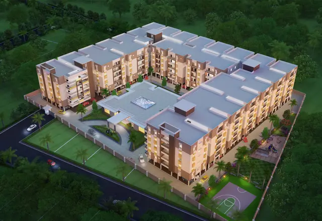
VANAMAALI is a residential project in TUMMALOOR, Maheshwaram, Ranga Reddy, on Survey Nos. 242 and 247/PART. The registered promoter is UDWAT PROJECTS PRIVATE LIMITED. The permit records a site area of 76093.62 sq.m and 140 residential buildings, generally Ground Floor + 2 Upper Floors; TG-RERA’s unit table lists 420 homes: 279 1BHK and 141 2BHK. The project is registered under TG-RERA number P02400011116, with proposed completion by 13/06/2031.
01What we found
Read from TG-RERA filings, approvals, land and registration records and court records. A court case is counted only when the court record states this project's survey number with its village, or names the project.
02Check before you pay
9 items to check before you pay, 3 high - from the title chain, court records and approvals, each with what to ask the builder or your advocate. An item may not be a problem with the project: records can be incomplete.
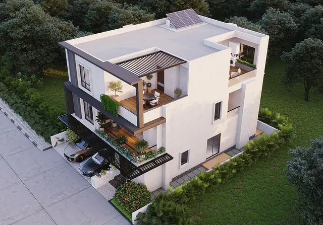
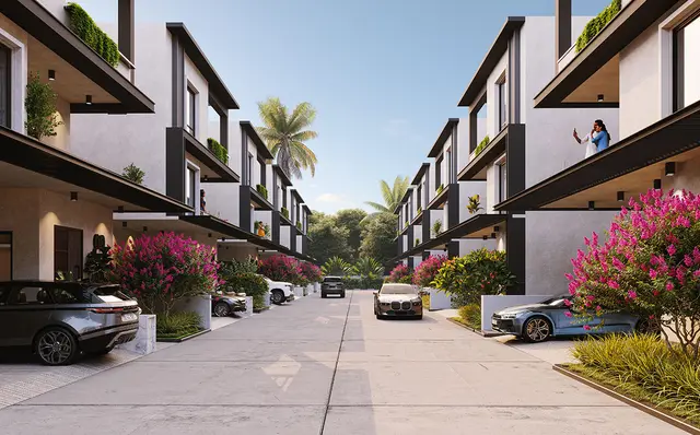
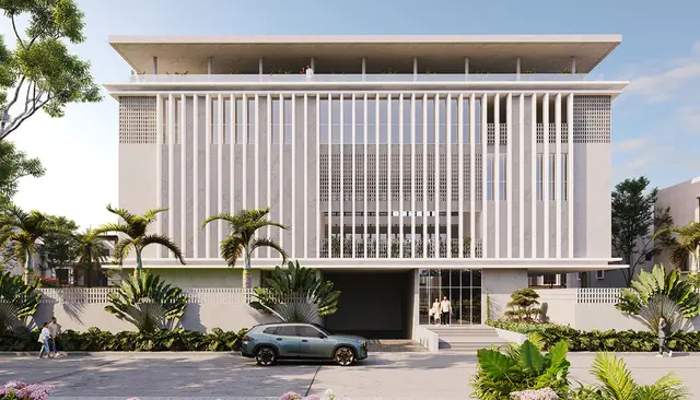
1. Project at a glance
Project identity
| Item | Record |
|---|---|
| Registered project name | VANAMAALI RERA record |
| Project type | TG-RERA records the project as residential; the filed permit describes a “Layout With Housing” / gated-community residential layout. RERA filing |
| Phase / registered portion | Phase is not separately identified in the supplied registration record. The registered land is identified as Survey Nos. 242 and 247/PART. |
| TG-RERA registration | P02400011116; Form C issued 04/08/2026; valid from 13/06/2026 to 13/06/2031. Registration validity is not itself an occupancy certificate or a statement that construction is complete. |
| Registered promoter | UDWAT PROJECTS PRIVATE LIMITED, a company. Corporate record |
| RERA status | Registered. The supplied certificate records a five-year registration period and requires quarterly updates. |
Land and geographic identity
| Item | Record |
|---|---|
| Locality / revenue village | Locality: TUMMALOOR; revenue village named in project records: Thummaloor (also written “Tummaloor” / “Thummalur” in filed documents). RERA record |
| Mandal / district / PIN | Maheshwaram, Ranga Reddy, 501359. RERA record |
| Project survey numbers | 242, 247/PART; the permit also writes these as 242 and 247Part. No further project subdivision is specified in the registration certificate. |
| Registered site extent | Certificate lists the site as OPEN LAND; the permit records site area 76093.62 sq.m, road-affected area 4264.99 sq.m, nala-affected area 1510.81 sq.m, and net area 66861.21 sq.m. |
| Boundaries | East: ROAD; west, north and south: OTHERS LAND. RERA filing |
Development identity
| Item | Record |
|---|---|
| Sanctioning authority | The filed layout-with-housing permit identifies Future City Development Authority (FCDA); the subsequent permit is issued by Tummaloor Gram Panchayat. |
| Principal approval | Layout Permit 010054/FCDA/00071/SWDL/MAH/2025, dated 15/11/2025; permit number 0079/FCDA/SWDL/2026, dated 13/06/2026. |
| Approved built-up area | 59939.96 sq.m (recorded as “Total Sanctioned Built Up Area”). |
| Residential building count and floors | The permit records 140 dwelling units in buildings numbered 1–140, generally Ground Floor + 2 Upper Floors. |
| Amenity building | The permit also lists an AMENITIES building with 1 Cellar + Ground Floor + 3 Upper Floors and height 15.0 m. |
| Basement / parking levels | One cellar is listed for the amenity building; the supplied records do not establish a complete parking-level schedule for all residential buildings. |
| Unit counts | Permit: 140 dwelling units. TG-RERA portal unit table: 420 homes (279 filed as 1BHK and 141 as 2BHK); the supplied materials do not reconcile the scope of these counts. RERA unit table |
| Other approved building-area details | The permit lists Amenities 3016.1 without a unit in that line. |
Offering and status
| Item | Record |
|---|---|
| TG-RERA unit types | 1BHK and 2BHK, with filed saleable areas and counts set out below. RERA unit table |
| Booked / available | Portal snapshot lists 0 booked and 424 available overall; the unit-type breakdown lists 279 1BHK and 141 2BHK available. The portal data has no supplied as-of date, so counts are indicative. RERA unit table |
| Construction stage | No construction-progress percentage or independently verified site-progress report is supplied. Document index |
| Completion dates | Promoter Form B states completion by 13/06/2031; the registration certificate also expires 13/06/2031. The permit records construction to commence before 13/12/2026 and completion before 13/06/2031. |
| Occupancy / completion certificate | No occupancy or completion certificate is supplied; the approval extracts state that completion notice and an occupancy certificate are required before occupation. |
2. The project story
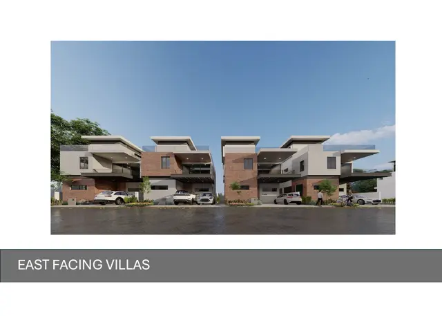
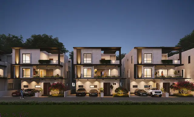
VANAMAALI is registered as a residential project on land in Thummaloor revenue village, Maheshwaram Mandal, Ranga Reddy District, under Survey Nos. 242 and 247/PART. Its filed permit describes a gated-community “layout with housing”: 140 numbered residential buildings, generally Ground Floor plus two upper floors, alongside a separate amenity building.
The approval records describe a large site with land set aside for roads, open space, utilities, amenities and affected portions. They also set out development works and conditions; these describe required or proposed infrastructure, not proof that it has been completed. No construction-stage certification or occupancy certificate is in the supplied evidence, so the present physical progress and any completed, occupied or OC-certified portion cannot be confirmed from this record.
The RERA portal’s unit table describes 1BHK and 2BHK configurations. The project’s filed permit, however, describes 140 dwelling units. The unit inventory is presented as recorded in the respective sources; the materials supplied do not explain how the portal configuration count relates to the permit’s dwelling-unit count. RERA unit table
3. Master plan, architecture & building design
The permit records a 76093.62 sq.m site, 66861.21 sq.m net area, and 59939.96 sq.m total sanctioned built-up area. It identifies 140 residential buildings, generally Ground Floor + 2 Upper Floors, and an amenity building with 1 Cellar + Ground Floor + 3 Upper Floors. The permit records residential building height of 9.9 m and amenity-building height of 15.0 m.
The filed layout drawing’s area statement allocates the 66861.21 sq.m net layout area as follows. These are drawing-derived figures, not a separate survey measurement.
| Layout component | Area | Share shown |
|---|---|---|
| Plotted Area | 36041.33 sq.m | 53.90 % |
| Amenities Plot Area | 1505.03 sq.m | 2.25 % |
| Road Area | 14414.38 sq.m | 21.56 % |
| Organized Open Space Area | 7654.21 sq.m | 11.45 % |
| Buffer Area | 1448.47 sq.m | 2.17 % |
| Utility Area | 901.28 sq.m | 1.35 % |
| Future Development Area | 4896.68 sq.m | 7.32 % |
| Social Infrastructure Area | 0.00 sq.m | 0 % |
| Common Parking Area | 0.00 sq.m | 0 % |
| Green Belt Area | 0.00 sq.m | 0 % |
| Total Layout Area | 66861.21 sq.m | 100 % |
The layout drawing labels proposed roads of 12.19m and 10.06m, a 30m Existing Road Width, and a 60m Proposed Road Width. It also shows nala-buffer/widening features. The permit requires road formation, drainage, utility ducting, lighting, water and sewerage works, and development of open spaces; these are approval requirements, not evidence of delivery.
The permit identifies residential buildings 1–140 and the amenity block, but the supplied record does not provide a complete floor-by-floor schedule for each building, a project-wide parking-level plan, or independent as-built measurements. The drawing extract is a filed plan; its plotted areas and building labels should be checked against the signed approved drawing.
4. Homes, configurations & floor plans
TG-RERA’s portal unit table provides the configuration counts and saleable areas below. Bookings and availability are portal figures without a supplied as-of date. The measured carpet figures are software measurements from the drawing geometry, not RERA disclosures; they require review against the drawing. RERA unit table Floor plans
| Configuration | Units | Booked | Available | RERA saleable area | Measured carpet area | Loading (if supplied) |
|---|---|---|---|---|---|---|
| 1BHK | 279 | 0 | 279 | 138.24 sq.m | Median 113.7 sq.m; range 100.9–129.8 sq.m (software-measured) | 18% |
| 2BHK | 141 | 0 | 141 | 161.61 sq.m | Not supplied | Not supplied |
For 1BHK, the drawing measurement covers four flat designs. One extracted ground-floor plan identifies a guest room, living/dining, kitchen, servant room, two toilets and a utility area; the utility area is marked excluded from the carpet-area calculation. The supplied plan extract does not provide a complete room-dimension schedule for all designs. RERA unit details
Carpet area is a drawing-based measurement of the home’s internal area; RERA saleable area is the filed figure and is a different area basis. The supplied data does not provide a separately verified carpet measurement for 2BHK. The drawing-derived 1BHK measurements and loading are not substitutes for the RERA-filed saleable-area figure. Floor plans RERA unit table
5. Parking & vehicle circulation
The layout drawing records Proposed Parking Area (sq.m) 3729.37 and Visitor Parking Area proposed (sq.m) 82.37. It also shows Common Parking Area (sq.m) 0.00 sq.m in its land-use table. The supplied record does not establish a sanctioned parking-space count, resident/visitor bay allocation, accessible spaces, or an individual buyer’s exclusive parking entitlement.
The approval materials state that cellar and stilt areas approved for parking are to be used exclusively for vehicle parking, and identify a cellar in the amenity-building description. They do not provide a complete residential parking-level or ramp/entry/exit plan in the evidence supplied here. Electric-vehicle charging infrastructure is included as a permit condition for parking areas; installed chargers are not independently verified.
6. Amenities, recreation & open spaces
The filed layout plan and permit identify the following facilities. Listed areas are quoted as recorded; the evidence does not establish that these facilities are complete or independently verified. RERA amenities
| Description / size | 1 Cellar + Ground Floor + 3 Upper Floors; the permit lists “Amenities 3016.1” and the layout drawing lists an Amenities Plot Area of 1505.03 sq.m. |
|---|---|
| Declared progress / verified status | Permit/drawing record; completion not verified. |
| Description / size | Named in the filed drawing extract; no individual sizes or capacities supplied. |
|---|---|
| Declared progress / verified status | Drawing-extract features; delivery not verified. |
| Description / size | Drawing lists Tot-lot - 1 4895.56 sq.m, Tot-lot - 2 551.54 sq.m, and Tot-lot - 3 2207.12 sq.m; the area statement records organized open space of 7654.21 sq.m. |
|---|---|
| Declared progress / verified status | Planned/drawing-listed; completion not verified. |
| Description / size | Greenstrip and park development are identified in the filed layout/permit material. |
|---|---|
| Declared progress / verified status | Planned/required; completion not verified. |
| Description / size | TG-RERA amenity fields list Community Buildings; the permit identifies an amenity building. No additional facility size or capacity is supplied for this category. |
|---|---|
| Evidence source | RERA amenities |
| Declared progress / verified status | Portal/permit listing; completion not verified. |
| Description / size | Shown in the layout/amenity list. |
|---|---|
| Declared progress / verified status | Drawing-listed; operation not verified. |
The promoter’s website/vendor material lists further amenities, but the supplied project evidence does not establish those as approved or delivered facilities; they are therefore not treated here as project-approved amenities. Promoter website
7. Utilities, building services & safety
The permit describes development works and conditions for internal water-supply pipelines, an overhead tank, protected water supply, an independent sewerage-disposal system and STP or common septic tank, underground storm-water drainage, utility ducting, transformer yard, street lighting, garbage disposal and rainwater-harvesting works. These are approval descriptions and requirements; installed capacities and completed status are not documented in the supplied evidence.
The filed layout extract labels a sump, STP, transformer yard, public utility, garbage pit and security room. It also records No. of Rain Water Harvesting Pits 0 in the permit parameters while the conditions require rainwater-harvesting provisions; actual provision is not established here.
The permit conditions address fire-fighting installations, fire NOC before occupancy, structural and means-of-escape safety, technical supervision, electrical safety distances, accessibility provisions for applicable public/semi-public buildings, and broadband/digital-connectivity infrastructure. These conditions do not establish that clearances have been obtained or systems installed. No lift count, lift capacity, backup-power capacity, water-storage capacity, STP capacity, fire-system schedule or accessibility plan is supplied.
8. Location, access & connectivity
The registered revenue location is Thummaloor, Maheshwaram Mandal, Ranga Reddy District, PIN 501359; the project record uses the locality name TUMMALOOR. RERA record
The filed site boundaries identify a road on the east and other land on the west, north and south. The layout drawing labels road widths of 12.19m, 10.06m, 30m Existing Road Width and 60m Proposed Road Width. A supplied location record gives the nearest sampled Outer Ring Road interchange as approximately 13.5 km; this is a sampled-map distance, not a travel-time estimate. RERA filing Location record
No public-transport details or independently measured distances to schools, hospitals or other landmarks are supplied in the project-location evidence. Location record
9. Developer & development status
The registered promoter is UDWAT PROJECTS PRIVATE LIMITED, a private limited company, GSTIN 36AADCU2881M1ZU. The supplied company record identifies authorized signatory DATLA SAMATHA RANI and director PADIDAM VEERASWAMY. Corporate record Parties record
The RERA certificate lists the promoter office as Village: Madhapur, Mandal: Serilingampally, District: Ranga Reddy, PIN 500081. The project address is separately recorded at Tummaloor, Maheshwaram, Ranga Reddy, PIN 501359. Parties record
The promoter’s Form B declaration dated 22-06-2026 states that the project land is free from encumbrances and declares completion by 13/06/2031. These are promoter declarations. The supplied material gives no certified construction-progress percentage, site inspection, or phase-wise completion report; the project’s current construction stage cannot be established from this evidence. Document index
10. Approvals, official records & documents
| Record | What the supplied material establishes |
|---|---|
| TG-RERA Form C, P02400011116 | Registration certificate for VANAMAALI, issued 04/08/2026; validity 13/06/2026–13/06/2031. |
| FCDA layout-with-housing permit, 010054/FCDA/00071/SWDL/MAH/2025 | Technical approval for a draft gated-community residential layout proposal on Survey Nos. 242 and 247Part, dated 15/11/2025. |
| Tummaloor Gram Panchayat permit, 0079/FCDA/SWDL/2026 | Layout-with-housing permit dated 13/06/2026, recording site and net areas, 140 dwelling units, building details and conditions. |
| Filed layout plan | Proposed layout drawing with plots, roads, open space, amenities, utilities and buffers; the extract does not identify its issuing authority or approval stamp. |
| Form B promoter declaration | Dated 22-06-2026; includes promoter declarations about title, encumbrances, separate-account arrangements and completion date. |
| Occupancy/completion certificate | None supplied. The permit material calls for completion notice and an occupancy certificate before occupation. |
The supplied approval material does not include an occupancy certificate or evidence of completed construction. The permit conditions are summarized where relevant above; the full conditions and their project-specific application should be read in the source documents.
1. Project at a glance
Project identity
Registered project name: VANAMAALI
Project type: TG-RERA records the project as residential; the filed permit describes a “Layout With Housing” / gated-community residential layout.
Phase / registered portion: Phase is not separately identified in the supplied registration record. The registered land is identified as Survey Nos. 242 and 247/PART.
TG-RERA registration: P02400011116; Form C issued 04/08/2026; valid from 13/06/2026 to 13/06/2031. Registration validity is not itself an occupancy certificate or a statement that construction is complete.
Registered promoter: UDWAT PROJECTS PRIVATE LIMITED, a company.
RERA status: Registered. The supplied certificate records a five-year registration period and requires quarterly updates.
Land and geographic identity
Locality / revenue village: Locality: TUMMALOOR; revenue village named in project records: Thummaloor (also written “Tummaloor” / “Thummalur” in filed documents).
Mandal / district / PIN: Maheshwaram, Ranga Reddy, 501359.
Project survey numbers: 242, 247/PART; the permit also writes these as 242 and 247Part. No further project subdivision is specified in the registration certificate.
Registered site extent: Certificate lists the site as OPEN LAND; the permit records site area 76093.62 sq.m, road-affected area 4264.99 sq.m, nala-affected area 1510.81 sq.m, and net area 66861.21 sq.m.
Boundaries: East: ROAD; west, north and south: OTHERS LAND.
Development identity
Sanctioning authority: The filed layout-with-housing permit identifies Future City Development Authority (FCDA); the subsequent permit is issued by Tummaloor Gram Panchayat.
Principal approval: Layout Permit 010054/FCDA/00071/SWDL/MAH/2025, dated 15/11/2025; permit number 0079/FCDA/SWDL/2026, dated 13/06/2026.
Approved built-up area: 59939.96 sq.m (recorded as “Total Sanctioned Built Up Area”).
Residential building count and floors: The permit records 140 dwelling units in buildings numbered 1–140, generally Ground Floor + 2 Upper Floors.
Amenity building: The permit also lists an AMENITIES building with 1 Cellar + Ground Floor + 3 Upper Floors and height 15.0 m.
Basement / parking levels: One cellar is listed for the amenity building; the supplied records do not establish a complete parking-level schedule for all residential buildings.
Unit counts: Permit: 140 dwelling units. TG-RERA portal unit table: 420 homes (279 filed as 1BHK and 141 as 2BHK); the supplied materials do not reconcile the scope of these counts.
Other approved building-area details: The permit lists Amenities 3016.1 without a unit in that line.
Offering and status
TG-RERA unit types: 1BHK and 2BHK, with filed saleable areas and counts set out below.
Booked / available: Portal snapshot lists 0 booked and 424 available overall; the unit-type breakdown lists 279 1BHK and 141 2BHK available. The portal data has no supplied as-of date, so counts are indicative.
Construction stage: No construction-progress percentage or independently verified site-progress report is supplied.
Completion dates: Promoter Form B states completion by 13/06/2031; the registration certificate also expires 13/06/2031. The permit records construction to commence before 13/12/2026 and completion before 13/06/2031.
Occupancy / completion certificate: No occupancy or completion certificate is supplied; the approval extracts state that completion notice and an occupancy certificate are required before occupation.
2. The project story
VANAMAALI is registered as a residential project on land in Thummaloor revenue village, Maheshwaram Mandal, Ranga Reddy District, under Survey Nos. 242 and 247/PART. Its filed permit describes a gated-community “layout with housing”: 140 numbered residential buildings, generally Ground Floor plus two upper floors, alongside a separate amenity building.
The approval records describe a large site with land set aside for roads, open space, utilities, amenities and affected portions. They also set out development works and conditions; these describe required or proposed infrastructure, not proof that it has been completed. No construction-stage certification or occupancy certificate is in the supplied evidence, so the present physical progress and any completed, occupied or OC-certified portion cannot be confirmed from this record.
The RERA portal’s unit table describes 1BHK and 2BHK configurations. The project’s filed permit, however, describes 140 dwelling units. The unit inventory is presented as recorded in the respective sources; the materials supplied do not explain how the portal configuration count relates to the permit’s dwelling-unit count.
3. Master plan, architecture & building design
The permit records a 76093.62 sq.m site, 66861.21 sq.m net area, and 59939.96 sq.m total sanctioned built-up area. It identifies 140 residential buildings, generally Ground Floor + 2 Upper Floors, and an amenity building with 1 Cellar + Ground Floor + 3 Upper Floors. The permit records residential building height of 9.9 m and amenity-building height of 15.0 m.
The filed layout drawing’s area statement allocates the 66861.21 sq.m net layout area as follows. These are drawing-derived figures, not a separate survey measurement.
| Layout component | Area | Share shown |
|---|---|---|
| Plotted Area | 36041.33 sq.m | 53.90 % |
| Amenities Plot Area | 1505.03 sq.m | 2.25 % |
| Road Area | 14414.38 sq.m | 21.56 % |
| Organized Open Space Area | 7654.21 sq.m | 11.45 % |
| Buffer Area | 1448.47 sq.m | 2.17 % |
| Utility Area | 901.28 sq.m | 1.35 % |
| Future Development Area | 4896.68 sq.m | 7.32 % |
| Social Infrastructure Area | 0.00 sq.m | 0 % |
| Common Parking Area | 0.00 sq.m | 0 % |
| Green Belt Area | 0.00 sq.m | 0 % |
| Total Layout Area | 66861.21 sq.m | 100 % |
The layout drawing labels proposed roads of 12.19m and 10.06m, a 30m Existing Road Width, and a 60m Proposed Road Width. It also shows nala-buffer/widening features. The permit requires road formation, drainage, utility ducting, lighting, water and sewerage works, and development of open spaces; these are approval requirements, not evidence of delivery.
The permit identifies residential buildings 1–140 and the amenity block, but the supplied record does not provide a complete floor-by-floor schedule for each building, a project-wide parking-level plan, or independent as-built measurements. The drawing extract is a filed plan; its plotted areas and building labels should be checked against the signed approved drawing.
4. Homes, configurations & floor plans
TG-RERA’s portal unit table provides the configuration counts and saleable areas below. Bookings and availability are portal figures without a supplied as-of date. The measured carpet figures are software measurements from the drawing geometry, not RERA disclosures; they require review against the drawing.
| Configuration | Units | Booked | Available | RERA saleable area | Measured carpet area | Loading (if supplied) |
|---|---|---|---|---|---|---|
| 1BHK | 279 | 0 | 279 | 138.24 sq.m | Median 113.7 sq.m; range 100.9–129.8 sq.m (software-measured) | 18% |
| 2BHK | 141 | 0 | 141 | 161.61 sq.m | Not supplied | Not supplied |
For 1BHK, the drawing measurement covers four flat designs. One extracted ground-floor plan identifies a guest room, living/dining, kitchen, servant room, two toilets and a utility area; the utility area is marked excluded from the carpet-area calculation. The supplied plan extract does not provide a complete room-dimension schedule for all designs.
Carpet area is a drawing-based measurement of the home’s internal area; RERA saleable area is the filed figure and is a different area basis. The supplied data does not provide a separately verified carpet measurement for 2BHK. The drawing-derived 1BHK measurements and loading are not substitutes for the RERA-filed saleable-area figure.
5. Parking & vehicle circulation
The layout drawing records Proposed Parking Area (sq.m) 3729.37 and Visitor Parking Area proposed (sq.m) 82.37. It also shows Common Parking Area (sq.m) 0.00 sq.m in its land-use table. The supplied record does not establish a sanctioned parking-space count, resident/visitor bay allocation, accessible spaces, or an individual buyer’s exclusive parking entitlement.
The approval materials state that cellar and stilt areas approved for parking are to be used exclusively for vehicle parking, and identify a cellar in the amenity-building description. They do not provide a complete residential parking-level or ramp/entry/exit plan in the evidence supplied here. Electric-vehicle charging infrastructure is included as a permit condition for parking areas; installed chargers are not independently verified.
6. Amenities, recreation & open spaces
The filed layout plan and permit identify the following facilities. Listed areas are quoted as recorded; the evidence does not establish that these facilities are complete or independently verified.
| Description / size | 1 Cellar + Ground Floor + 3 Upper Floors; the permit lists “Amenities 3016.1” and the layout drawing lists an Amenities Plot Area of 1505.03 sq.m. |
|---|---|
| Declared progress / verified status | Permit/drawing record; completion not verified. |
| Description / size | Named in the filed drawing extract; no individual sizes or capacities supplied. |
|---|---|
| Declared progress / verified status | Drawing-extract features; delivery not verified. |
| Description / size | Drawing lists Tot-lot - 1 4895.56 sq.m, Tot-lot - 2 551.54 sq.m, and Tot-lot - 3 2207.12 sq.m; the area statement records organized open space of 7654.21 sq.m. |
|---|---|
| Declared progress / verified status | Planned/drawing-listed; completion not verified. |
| Description / size | Greenstrip and park development are identified in the filed layout/permit material. |
|---|---|
| Declared progress / verified status | Planned/required; completion not verified. |
| Description / size | TG-RERA amenity fields list Community Buildings; the permit identifies an amenity building. No additional facility size or capacity is supplied for this category. |
|---|---|
| Declared progress / verified status | Portal/permit listing; completion not verified. |
| Description / size | Shown in the layout/amenity list. |
|---|---|
| Declared progress / verified status | Drawing-listed; operation not verified. |
The promoter’s website/vendor material lists further amenities, but the supplied project evidence does not establish those as approved or delivered facilities; they are therefore not treated here as project-approved amenities.
7. Utilities, building services & safety
The permit describes development works and conditions for internal water-supply pipelines, an overhead tank, protected water supply, an independent sewerage-disposal system and STP or common septic tank, underground storm-water drainage, utility ducting, transformer yard, street lighting, garbage disposal and rainwater-harvesting works. These are approval descriptions and requirements; installed capacities and completed status are not documented in the supplied evidence.
The filed layout extract labels a sump, STP, transformer yard, public utility, garbage pit and security room. It also records No. of Rain Water Harvesting Pits 0 in the permit parameters while the conditions require rainwater-harvesting provisions; actual provision is not established here.
The permit conditions address fire-fighting installations, fire NOC before occupancy, structural and means-of-escape safety, technical supervision, electrical safety distances, accessibility provisions for applicable public/semi-public buildings, and broadband/digital-connectivity infrastructure. These conditions do not establish that clearances have been obtained or systems installed. No lift count, lift capacity, backup-power capacity, water-storage capacity, STP capacity, fire-system schedule or accessibility plan is supplied.
8. Location, access & connectivity
The registered revenue location is Thummaloor, Maheshwaram Mandal, Ranga Reddy District, PIN 501359; the project record uses the locality name TUMMALOOR.
The filed site boundaries identify a road on the east and other land on the west, north and south. The layout drawing labels road widths of 12.19m, 10.06m, 30m Existing Road Width and 60m Proposed Road Width. A supplied location record gives the nearest sampled Outer Ring Road interchange as approximately 13.5 km; this is a sampled-map distance, not a travel-time estimate.
No public-transport details or independently measured distances to schools, hospitals or other landmarks are supplied in the project-location evidence.
9. Developer & development status
The registered promoter is UDWAT PROJECTS PRIVATE LIMITED, a private limited company, GSTIN 36AADCU2881M1ZU. The supplied company record identifies authorized signatory DATLA SAMATHA RANI and director PADIDAM VEERASWAMY.
The RERA certificate lists the promoter office as Village: Madhapur, Mandal: Serilingampally, District: Ranga Reddy, PIN 500081. The project address is separately recorded at Tummaloor, Maheshwaram, Ranga Reddy, PIN 501359.
The promoter’s Form B declaration dated 22-06-2026 states that the project land is free from encumbrances and declares completion by 13/06/2031. These are promoter declarations. The supplied material gives no certified construction-progress percentage, site inspection, or phase-wise completion report; the project’s current construction stage cannot be established from this evidence.
10. Approvals, official records & documents
TG-RERA Form C, P02400011116: Registration certificate for VANAMAALI, issued 04/08/2026; validity 13/06/2026–13/06/2031.
FCDA layout-with-housing permit, 010054/FCDA/00071/SWDL/MAH/2025: Technical approval for a draft gated-community residential layout proposal on Survey Nos. 242 and 247Part, dated 15/11/2025.
Tummaloor Gram Panchayat permit, 0079/FCDA/SWDL/2026: Layout-with-housing permit dated 13/06/2026, recording site and net areas, 140 dwelling units, building details and conditions.
Filed layout plan: Proposed layout drawing with plots, roads, open space, amenities, utilities and buffers; the extract does not identify its issuing authority or approval stamp.
Form B promoter declaration: Dated 22-06-2026; includes promoter declarations about title, encumbrances, separate-account arrangements and completion date.
Occupancy/completion certificate: None supplied. The permit material calls for completion notice and an occupancy certificate before occupation.
The supplied approval material does not include an occupancy certificate or evidence of completed construction. The permit conditions are summarized where relevant above; the full conditions and their project-specific application should be read in the source documents.
Frequently asked questions
Is VANAMAALI registered with Telangana RERA?
Yes. VANAMAALI is registered with the Telangana Real Estate Regulatory Authority as P02400011116; the registration status is New Project.
Who is the developer of VANAMAALI?
The promoter named in the RERA registration is UDWAT PROJECTS PRIVATE LIMITED.
Where is VANAMAALI located?
VANAMAALI is in TUMMALOOR, Thummaloor, Maheshwaram, Rangareddy, Telangana (501359).
When will VANAMAALI be completed?
The promoter's proposed date of completion filed with RERA is 13/10/2031. This is the promoter's declaration, not a guarantee.
More projects in Thummaloor