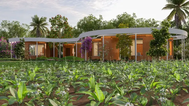
Lansum Evana
LANSUM PROPERTIES LLP · Rangareddy · RERA P02400009285
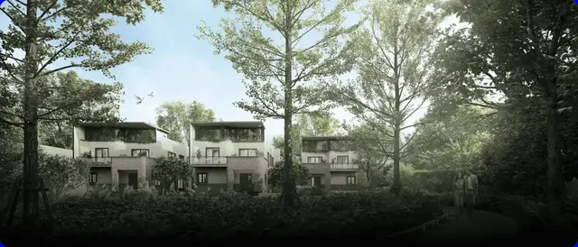
LANSUM EVANA is a Residential project in Kandawada Village, Chevella Mandal, Ranga Reddy District, developed by registered promoter LANSUM PROPERTIES LLP. The project has a total area of 142152.06 sq m and a net area of 138730.38 sq m; the filed plans show 251 villa homes and an amenity block, while the RERA unit record lists 1BHK and 2BHK configurations. The TG-RERA number is P02400009285, and the proposed completion date is 24/05/2030.
More from Lansum Properties LLP · 2 projects →
01What we found
Read from TG-RERA filings, approvals, land and registration records and court records. A court case is counted only when the court record states this project's survey number with its village, or names the project.
02Check before you pay
7 items to check before you pay, 4 high - from the title chain, court records and approvals, each with what to ask the builder or your advocate. An item may not be a problem with the project: records can be incomplete.
1. Project at a glance
Project identity
| Field | Project record |
|---|---|
| Registered project name | LANSUM EVANA RERA record |
| Project type / registered portion | RERA record: Residential, registered as a New Project; the filed building-permission documents describe villa development. The registration record does not specify a separate phase name. RERA record RERA filing |
| TG-RERA number | P02400009285 RERA record |
| Registration validity | 24/01/2025 to 24/01/2030, stated as a five-year period. This is the registration-validity period, not the project completion date. RERA record |
| Registered promoter | LANSUM PROPERTIES LLP RERA record Corporate record |
| RERA status | Registered; the supplied certificate states registration was granted under section 5. |
Land and geographic identity
| Field | Project record |
|---|---|
| Locality / revenue village | Kandawada Village (also printed as KANDAWADA VILLAGE in the filed documents). The evidence identifies this revenue village; it does not identify an additional project village. RERA record |
| Mandal / district / PIN | Chevella Mandal, Ranga Reddy District, 501503. RERA record |
| Project survey numbers as filed | SY NOs 677/PART, 678/PART, 679/PART, 680/PART, 681/PART, 682/PART AND 683/PART. Approval and plan records also refer to these in shortened form as 677P–683P or 677–683; the shortened references do not replace the full RERA-filed identity. RERA record |
| Total / plot area and net area | RERA land details state Total Area 142152.06 sq m, Area affected in Road widening/FTL of Tanks/Nala 3421.68 sq m, and Net Area 138730.38 sq m. The filed plan separately labels plot area 142152.06 and Nala widening area 3422.00; the plan’s net plot area is 138730.38. RERA filing |
| Registered extent | The registration certificate lists the project survey numbers but does not state a separate extent in its extracted certificate facts. The filed HMDA/Gram Panchayat permission records 138,730.38 Sq.m; the plan identifies 138730.38 as net area. |
| Boundaries | East: NEIGHBOURS LAND; West: GOVERNMENT LAND; North: NEIGHBOURS LAND; South: EXISTING 40 FEET WIDE ROAD. RERA filing |
Development identity
| Field | Project record |
|---|---|
| Sanctioning / technical authority | Hyderabad Metropolitan Development Authority (HMDA); the approval states that building plans are to be sanctioned and released by Palgutta Gram Panchayat. Approvals record |
| Principal approval | Building permission / technical approval 013112/BP/HMDA/3537/SKP/2024, dated 24 January 2025. Approvals record |
| Approved built-up area | 75,631.81 Sq.m in the filed permission. The layout plan separately states proposed built-up area excluding parking 75631.81 and including parking 139931.45; these are distinct plan labels. RERA filing |
| Building / block count | RERA land details state 252 total building units as per approved plan and 252 proposed building units as per agreement. The permission also records residential 252 and the plan records 251 villa homes plus an amenity block. RERA filing |
| Sanctioned floor configuration | The permission records residential 1 Cellar + 1 Ground + 3 upper floors and a clubhouse 1 Cellar + 1 Ground + 3 upper floors. The layout/building sheets also describe villa buildings with ground, first and terrace floors, with some sheets showing a cellar; individual villa drawings include a range of configurations. |
| Parking levels / counts | Plans and permission refer to cellar/parking use, but the supplied extracts do not establish a total sanctioned parking-space count or a unit-wise parking allocation. |
| Approved versus RERA-declared units | RERA fields state 252 approved-plan building units and 252 proposed units as per agreement; the RERA unit table identifies 502 homes in its two configurations and lists four additional common-area rows. The project records do not provide a reconciled unit schedule in the supplied extract. RERA filing RERA unit table RERA unit table |
Offering and status
| Field | Project record |
|---|---|
| RERA-filed configurations | 1BHK and 2BHK. RERA unit table RERA unit details |
| RERA saleable area | 1BHK: 135.19–192.56 sq m; 2BHK: 196.29–285.78 sq m. RERA unit table |
| Portal booking / availability snapshot | 50 booked and 456 available in the normalized unit record; the portal extract has no as-of date, so these are indicative counts, not a dated sales statement. RERA unit table |
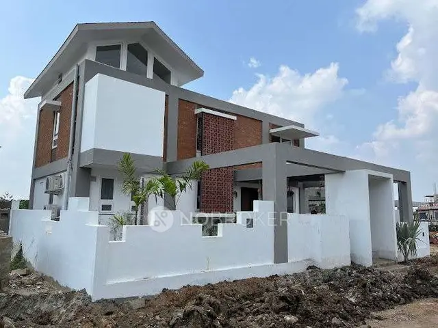
| Construction stage | No independently verified construction-progress percentage or site inspection status is supplied. The project is described in the RERA filing as a new project with proposed development. RERA filing Document index |
| Completion dates | The RERA project-information field gives proposed completion 24/05/2030. The Form B declaration states an undertaking to complete on or before 24/01/2028. RERA record RERA filing |
| Occupancy / completion certificate status | No occupancy certificate or completion certificate is included in the supplied records; the permission states an Occupancy Certificate is compulsory before occupation. No phase- or tower-wise OC status is supplied. |
2. The project story
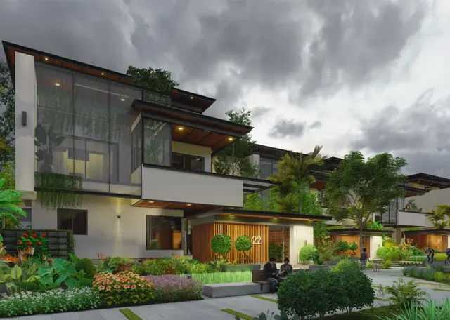
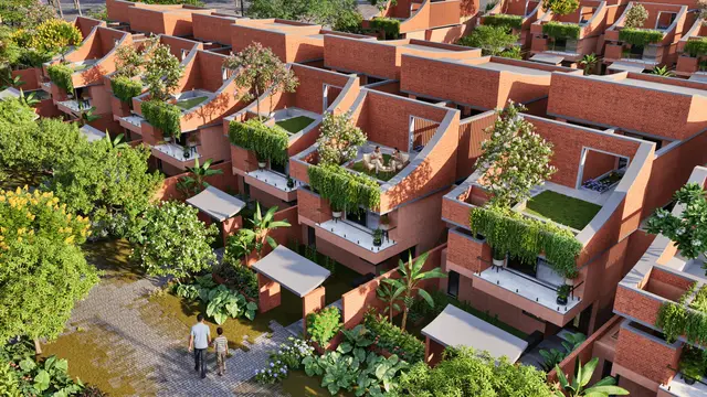
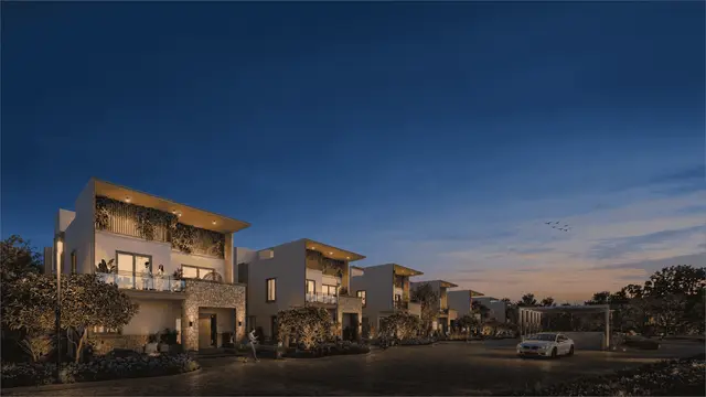
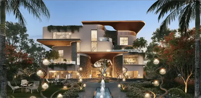
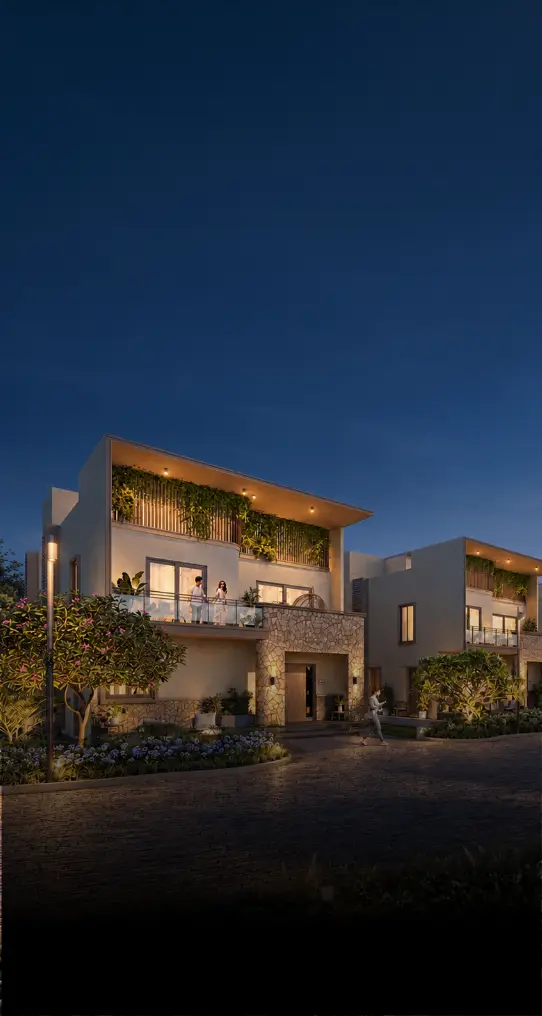
LANSUM EVANA is a residential gated-community development in Kandawada Village, Chevella Mandal, Ranga Reddy District. Its filed planning material describes villa housing across the project land, with a clubhouse and common/open-space components. The principal permission identifies a residential development and a clubhouse; the layout sheets show villa plots/buildings, internal roads and pathways, a stream/nala-related area, tot-lots and entrance-plaza features. RERA record
The project is registered with TG-RERA, and the supplied records contain a building-permission order and plan drawings. Those records do not establish how much construction has physically been completed or independently inspected. The promoter’s Form B sets out a completion undertaking; the RERA project-information record also carries a proposed completion date. Neither date is evidence that construction is complete, and no occupancy certificate is supplied. RERA filing Document index
3. Master plan, architecture & building design
The filed site figures distinguish total/plot area, nala-affected area and net area. The RERA land details give 142152.06 sq m total, 3421.68 sq m affected and 138730.38 sq m net. The plan sheet labels 3422.00 as Nala Widening Area and 138730.38 as Net Area of Plot. These are plan/RERA record figures, not independently surveyed measurements. RERA filing
The principal permission records 75,631.81 Sq.m built-up area and a residential configuration of 1 Cellar + 1 Ground + 3 upper floors; the clubhouse is also recorded as 1 Cellar + 1 Ground + 3 upper floors. The layout plan gives proposed built-up area excluding parking as 75631.81 and including parking as 139931.45. The plan extracts also show villa-type building drawings, commonly described with ground, first and terrace floors, and selected drawings include cellar levels.
The layout plan labels 12.00 MT WIDE EXISTING and 12.00 MT WIDE PROPOSED ROAD; other drawing sheets identify internal roads and pedestrian paths, including 30'0" WIDE ROAD, EXIST 40'-0" WIDE ROAD, 9.14 M WIDE PATH WAY, 8.1 M WIDE PEDESTRIAN PATH WAY, 12.19 M WIDE PATH WAY, and 9.14 M PATH WAY CONNECTING BRIDGE. These are drawing labels; no independent site measurement or current construction verification is supplied.
The plan sheets label 25 tot-lots, open areas, an entrance plaza, a green strip, a clubhouse and a stream/nala. The OCR does not provide a complete, reliably reconciled area schedule for the overall open-space distribution, villa footprints or all building configurations.
4. Homes, configurations & floor plans
The RERA unit record lists 1BHK and 2BHK configurations. Saleable area below is the RERA-filed figure; it is not interchangeable with carpet area. For 1BHK, software measurement from the supplied plan drawings found carpet-area results across three measured designs. This is drawing-based software measurement, not a RERA disclosure, and the measurement record says it needs review. No comparable software-measured carpet-area range is supplied for 2BHK. RERA unit table RERA unit details Floor plans
| Configuration | Units | Booked | Available | RERA saleable area | Measured carpet area | Loading (if supplied) |
|---|---|---|---|---|---|---|
| 1BHK | 252 | 25 | 227 | 135.19–192.56 sq m | Software-measured across 3 designs: 92.7–127.8 sq m; median 108.0 sq m (1163 sq ft) | Not supplied |
| 2BHK | 250 | 25 | 225 | 196.29–285.78 sq m | Not supplied | Not supplied |
RERA’s 1BHK rows are filed as “1 BEDROOMS BALCONY” and “1BHK”; its 2BHK rows are “2 BEDROOMS,” “2 BEDROOMS BALCONY,” and “2 BEDROOMS LOUNGE.” The portal booking/availability counts are not dated in the supplied record and should be treated as indicative. RERA unit details RERA unit table
The measured 1BHK drawing sample includes a kitchen, bedroom, drawing room, lobby, toilet/WC, dress room and servant room. One supplied drawing records a kitchen of 4.63 × 4.27 m, bedroom of 4.63 × 3.73 m, and drawing room of 3.48 × 3.64 m. These are software-read drawing dimensions, not RERA-filed measurements; verify them against the relevant plan. RERA unit details
5. Parking & vehicle circulation
The filed plan and permission indicate cellar/parking provision. The layout conditions specify that the cellar/stilt floor is to be used for parking, and the plan drawings label parking and vehicular ramps. One drawing extract records ramps of 26.80 mt. long, 3.00 mt. High, 5.00 mt. Wide and 26.00 mt. long, 3.00 mt. High, 5.00 mt. Wide.
The supplied extracts do not establish the total number of parking spaces, resident/visitor or accessible-space counts, or the parking allocation attached to any sale unit. A drawn bay or parking label does not establish exclusive ownership or a unit-specific allotment. Document index
6. Amenities, recreation & open spaces
The filed plans identify a clubhouse, entrance plaza, open areas, green strip, tot-lots and a stream/nala feature. The plan extracts list 25 tot-lots; the area figures below are the individual drawing labels, not a verified completed-site inventory.
| Description / size | Shown as a common amenity building; permission describes 1 Cellar + 1 Ground + 3 upper floors. No clubhouse area is established in the supplied extract. |
|---|---|
| Declared progress / verified status | Shown in filed permission/plans; construction and completion not independently verified. |
| Description / size | Plan labels tot-lots 1–25. The supplied area labels include 311.19 sq m, 219.16 sq m, 145.44 sq m, 1075.52 sq m, 1477.93 sq m, 205.68 sq m, 777.00 sq m, 523.90 sq m, 838.67 sq m, 1382.50 sq m, 268.06 sq m, 368.95 sq m, 69.61 sq m, 124.52 sq m, 57.63 sq m, 274.07 sq m, 306.91 sq m, 78.23 sq m, 1155.19 sq m, 2258.79 sq m, 339.96 sq m, 145.80 sq m, 598.53 sq m, 1032.46 sq m, and 212.28 sq m. |
|---|---|
| Declared progress / verified status | Plan labels only; progress and completion not independently verified. |
| Description / size | One drawing labels OPEN AREA 162.52 SQ.M. |
|---|---|
| Declared progress / verified status | Plan label; no completion verification supplied. |
| Description / size | Identified on the plan sheets; no size supplied. |
|---|---|
| Declared progress / verified status | Plan label; progress not supplied. |
| Description / size | Identified on the layout plan; no area supplied in the extracted record. |
|---|---|
| Declared progress / verified status | Plan label; progress not supplied. |
| Description / size | A 9.14 M PATH WAY CONNECTING BRIDGE and pedestrian-path labels appear in the plan extracts. |
|---|---|
| Declared progress / verified status | Drawing labels; construction and completion not independently verified. |
The brochure lists additional recreational and community features, including sports courts, a swimming pool, gym, co-working/reading spaces, garden zones and gathering areas. These are promoter-marketed claims and are not represented here as confirmed sanctioned or delivered facilities.
7. Utilities, building services & safety
The permission and plan records refer to a 25,000-litre separate underground static water storage tank and a 25,000-litre separate terrace tank for residential buildings. The filed conditions also call for rainwater-harvesting structures and show a distribution transformer. The supplied evidence does not establish the water source, current installation status or operating capacity.
The filed plan/permission documents identify STP, septic tank, sump and underground drainage, and specify that sewage treatment and disposal arrangements are to be provided. No STP capacity, commissioning evidence or independently verified operational status is supplied. The plan also identifies storm-water drains and rainwater harvesting; completion is not verified. RERA amenities
The approval records fire-safety-related requirements, including sprinklers if basement area exceeds 200 Sq.mts, and at least four fire extinguishers per floor in the building-permit extract. These are approval conditions, not evidence that the systems have been installed or that statutory compliance has been verified. The extract does not establish lift counts/capacities, CCTV installation, waste-management operating arrangements or accessible circulation.
The plan conditions refer to Electric Vehicle Charging Infrastructure in parking places. This is a stated planning condition; the supplied evidence does not show installed chargers or their count.
8. Location, access & connectivity
The registered location is Kandawada Village, Chevella Mandal, Ranga Reddy District, Telangana 501503. The filed land boundaries identify an EXISTING 40 FEET WIDE ROAD on the south. The plan also labels existing and proposed roads and internal pedestrian paths. RERA record RERA filing
The supplied location record gives the Financial District (Nanakramguda) at 23.4 km. No other independently measured distance or verified travel time is supplied. Location record
9. Developer & development status
The registered promoter is LANSUM PROPERTIES LLP, an LLP, with GSTIN 36AALFL2325C1ZN. The promoter address in the supplied project record is LANSUM HOUSE, ROAD NO 78, UNDER PALGUTTA GRAM PANCHAYATH, KANDAWADA VILLAGE, Chevella, Ranga Reddy, 501503. The named authorized signatory is KUNAPAREDDY UMESH; the project record also lists KUNAPAREDDY LAKSHMI as partner. Corporate record Parties record RERA filing
The project is RERA-registered and has a filed building-permission order. The supplied evidence does not state a verified construction percentage, independently confirmed site stage, or phase-/tower-wise delivery status. The Form B affidavit dated 25-01-2025 undertakes completion on or before 24/01/2028; the RERA project-information field gives proposed completion 24/05/2030. The records do not include an occupancy certificate. RERA filing Document index
10. Approvals, official records & documents
| Identifier / date | P02400009285; valid 24/01/2025–24/01/2030 |
|---|---|
| What the supplied record establishes | Form C registration certificate for LANSUM EVANA; lists the project location, survey numbers and promoter obligations. |
| Identifier / date | 013112/BP/HMDA/3537/SKP/2024; 24 January 2025 |
|---|---|
| What the supplied record establishes | Building-permission material for the project land at Kandawada; the permission identifies residential and clubhouse configurations and records conditions including occupancy certification. |
| Identifier / date | File No. TS/062190/2024; sheets 02 / 07, 03 / 07, 04 / 07, and 7 / 7 appear in the extracted plan records |
|---|---|
| What the supplied record establishes | Plan drawings identify the proposed gated-community layout, villa buildings, internal roads/pathways, tot-lots, open areas, clubhouse and nala-related plan features. The supplied OCR does not provide a legible approval number/date on each sheet. |
| Identifier / date | Dated 25-01-2025 |
|---|---|
| What the supplied record establishes | Promoter affidavit states the land is free from encumbrances and sets out the promoter’s completion and project-fund undertakings. |
| Identifier / date | Not supplied |
|---|---|
| What the supplied record establishes | The permission states an Occupancy Certificate is compulsory before occupation; no project- or building-specific OC is present in the supplied evidence. |
| Identifier / date | Documents 279/2025 and 280/2025, dated 21 January 2025 |
|---|---|
| What the supplied record establishes | The approval material records mortgages in favour of HMDA over specified project areas/units. |
1. Project at a glance
Project identity
Registered project name: LANSUM EVANA
Project type / registered portion: RERA record: Residential, registered as a New Project; the filed building-permission documents describe villa development. The registration record does not specify a separate phase name.
TG-RERA number: P02400009285
Registration validity: 24/01/2025 to 24/01/2030, stated as a five-year period. This is the registration-validity period, not the project completion date.
Registered promoter: LANSUM PROPERTIES LLP
RERA status: Registered; the supplied certificate states registration was granted under section 5.
Land and geographic identity
Locality / revenue village: Kandawada Village (also printed as KANDAWADA VILLAGE in the filed documents). The evidence identifies this revenue village; it does not identify an additional project village.
Mandal / district / PIN: Chevella Mandal, Ranga Reddy District, 501503.
Project survey numbers as filed: SY NOs 677/PART, 678/PART, 679/PART, 680/PART, 681/PART, 682/PART AND 683/PART. Approval and plan records also refer to these in shortened form as 677P–683P or 677–683; the shortened references do not replace the full RERA-filed identity.
Total / plot area and net area: RERA land details state Total Area 142152.06 sq m, Area affected in Road widening/FTL of Tanks/Nala 3421.68 sq m, and Net Area 138730.38 sq m. The filed plan separately labels plot area 142152.06 and Nala widening area 3422.00; the plan’s net plot area is 138730.38.
Registered extent: The registration certificate lists the project survey numbers but does not state a separate extent in its extracted certificate facts. The filed HMDA/Gram Panchayat permission records 138,730.38 Sq.m; the plan identifies 138730.38 as net area.
Boundaries: East: NEIGHBOURS LAND; West: GOVERNMENT LAND; North: NEIGHBOURS LAND; South: EXISTING 40 FEET WIDE ROAD.
Development identity
Sanctioning / technical authority: Hyderabad Metropolitan Development Authority (HMDA); the approval states that building plans are to be sanctioned and released by Palgutta Gram Panchayat.
Principal approval: Building permission / technical approval 013112/BP/HMDA/3537/SKP/2024, dated 24 January 2025.
Approved built-up area: 75,631.81 Sq.m in the filed permission. The layout plan separately states proposed built-up area excluding parking 75631.81 and including parking 139931.45; these are distinct plan labels.
Building / block count: RERA land details state 252 total building units as per approved plan and 252 proposed building units as per agreement. The permission also records residential 252 and the plan records 251 villa homes plus an amenity block.
Sanctioned floor configuration: The permission records residential 1 Cellar + 1 Ground + 3 upper floors and a clubhouse 1 Cellar + 1 Ground + 3 upper floors. The layout/building sheets also describe villa buildings with ground, first and terrace floors, with some sheets showing a cellar; individual villa drawings include a range of configurations.
Parking levels / counts: Plans and permission refer to cellar/parking use, but the supplied extracts do not establish a total sanctioned parking-space count or a unit-wise parking allocation.
Approved versus RERA-declared units: RERA fields state 252 approved-plan building units and 252 proposed units as per agreement; the RERA unit table identifies 502 homes in its two configurations and lists four additional common-area rows. The project records do not provide a reconciled unit schedule in the supplied extract.
Offering and status
RERA-filed configurations: 1BHK and 2BHK.
RERA saleable area: 1BHK: 135.19–192.56 sq m; 2BHK: 196.29–285.78 sq m.
Portal booking / availability snapshot: 50 booked and 456 available in the normalized unit record; the portal extract has no as-of date, so these are indicative counts, not a dated sales statement.
Construction stage: No independently verified construction-progress percentage or site inspection status is supplied. The project is described in the RERA filing as a new project with proposed development.
Completion dates: The RERA project-information field gives proposed completion 24/05/2030. The Form B declaration states an undertaking to complete on or before 24/01/2028.
Occupancy / completion certificate status: No occupancy certificate or completion certificate is included in the supplied records; the permission states an Occupancy Certificate is compulsory before occupation. No phase- or tower-wise OC status is supplied.
2. The project story
LANSUM EVANA is a residential gated-community development in Kandawada Village, Chevella Mandal, Ranga Reddy District. Its filed planning material describes villa housing across the project land, with a clubhouse and common/open-space components. The principal permission identifies a residential development and a clubhouse; the layout sheets show villa plots/buildings, internal roads and pathways, a stream/nala-related area, tot-lots and entrance-plaza features.
The project is registered with TG-RERA, and the supplied records contain a building-permission order and plan drawings. Those records do not establish how much construction has physically been completed or independently inspected. The promoter’s Form B sets out a completion undertaking; the RERA project-information record also carries a proposed completion date. Neither date is evidence that construction is complete, and no occupancy certificate is supplied.
3. Master plan, architecture & building design
The filed site figures distinguish total/plot area, nala-affected area and net area. The RERA land details give 142152.06 sq m total, 3421.68 sq m affected and 138730.38 sq m net. The plan sheet labels 3422.00 as Nala Widening Area and 138730.38 as Net Area of Plot. These are plan/RERA record figures, not independently surveyed measurements.
The principal permission records 75,631.81 Sq.m built-up area and a residential configuration of 1 Cellar + 1 Ground + 3 upper floors; the clubhouse is also recorded as 1 Cellar + 1 Ground + 3 upper floors. The layout plan gives proposed built-up area excluding parking as 75631.81 and including parking as 139931.45. The plan extracts also show villa-type building drawings, commonly described with ground, first and terrace floors, and selected drawings include cellar levels.
The layout plan labels 12.00 MT WIDE EXISTING and 12.00 MT WIDE PROPOSED ROAD; other drawing sheets identify internal roads and pedestrian paths, including 30'0" WIDE ROAD, EXIST 40'-0" WIDE ROAD, 9.14 M WIDE PATH WAY, 8.1 M WIDE PEDESTRIAN PATH WAY, 12.19 M WIDE PATH WAY, and 9.14 M PATH WAY CONNECTING BRIDGE. These are drawing labels; no independent site measurement or current construction verification is supplied.
The plan sheets label 25 tot-lots, open areas, an entrance plaza, a green strip, a clubhouse and a stream/nala. The OCR does not provide a complete, reliably reconciled area schedule for the overall open-space distribution, villa footprints or all building configurations.
4. Homes, configurations & floor plans
The RERA unit record lists 1BHK and 2BHK configurations. Saleable area below is the RERA-filed figure; it is not interchangeable with carpet area. For 1BHK, software measurement from the supplied plan drawings found carpet-area results across three measured designs. This is drawing-based software measurement, not a RERA disclosure, and the measurement record says it needs review. No comparable software-measured carpet-area range is supplied for 2BHK.
| Configuration | Units | Booked | Available | RERA saleable area | Measured carpet area | Loading (if supplied) |
|---|---|---|---|---|---|---|
| 1BHK | 252 | 25 | 227 | 135.19–192.56 sq m | Software-measured across 3 designs: 92.7–127.8 sq m; median 108.0 sq m (1163 sq ft) | Not supplied |
| 2BHK | 250 | 25 | 225 | 196.29–285.78 sq m | Not supplied | Not supplied |
RERA’s 1BHK rows are filed as “1 BEDROOMS BALCONY” and “1BHK”; its 2BHK rows are “2 BEDROOMS,” “2 BEDROOMS BALCONY,” and “2 BEDROOMS LOUNGE.” The portal booking/availability counts are not dated in the supplied record and should be treated as indicative.
The measured 1BHK drawing sample includes a kitchen, bedroom, drawing room, lobby, toilet/WC, dress room and servant room. One supplied drawing records a kitchen of 4.63 × 4.27 m, bedroom of 4.63 × 3.73 m, and drawing room of 3.48 × 3.64 m. These are software-read drawing dimensions, not RERA-filed measurements; verify them against the relevant plan.
5. Parking & vehicle circulation
The filed plan and permission indicate cellar/parking provision. The layout conditions specify that the cellar/stilt floor is to be used for parking, and the plan drawings label parking and vehicular ramps. One drawing extract records ramps of 26.80 mt. long, 3.00 mt. High, 5.00 mt. Wide and 26.00 mt. long, 3.00 mt. High, 5.00 mt. Wide.
The supplied extracts do not establish the total number of parking spaces, resident/visitor or accessible-space counts, or the parking allocation attached to any sale unit. A drawn bay or parking label does not establish exclusive ownership or a unit-specific allotment.
6. Amenities, recreation & open spaces
The filed plans identify a clubhouse, entrance plaza, open areas, green strip, tot-lots and a stream/nala feature. The plan extracts list 25 tot-lots; the area figures below are the individual drawing labels, not a verified completed-site inventory.
| Description / size | Shown as a common amenity building; permission describes 1 Cellar + 1 Ground + 3 upper floors. No clubhouse area is established in the supplied extract. |
|---|---|
| Declared progress / verified status | Shown in filed permission/plans; construction and completion not independently verified. |
| Description / size | Plan labels tot-lots 1–25. The supplied area labels include 311.19 sq m, 219.16 sq m, 145.44 sq m, 1075.52 sq m, 1477.93 sq m, 205.68 sq m, 777.00 sq m, 523.90 sq m, 838.67 sq m, 1382.50 sq m, 268.06 sq m, 368.95 sq m, 69.61 sq m, 124.52 sq m, 57.63 sq m, 274.07 sq m, 306.91 sq m, 78.23 sq m, 1155.19 sq m, 2258.79 sq m, 339.96 sq m, 145.80 sq m, 598.53 sq m, 1032.46 sq m, and 212.28 sq m. |
|---|---|
| Declared progress / verified status | Plan labels only; progress and completion not independently verified. |
| Description / size | One drawing labels OPEN AREA 162.52 SQ.M. |
|---|---|
| Declared progress / verified status | Plan label; no completion verification supplied. |
| Description / size | Identified on the plan sheets; no size supplied. |
|---|---|
| Declared progress / verified status | Plan label; progress not supplied. |
| Description / size | Identified on the layout plan; no area supplied in the extracted record. |
|---|---|
| Declared progress / verified status | Plan label; progress not supplied. |
| Description / size | A 9.14 M PATH WAY CONNECTING BRIDGE and pedestrian-path labels appear in the plan extracts. |
|---|---|
| Declared progress / verified status | Drawing labels; construction and completion not independently verified. |
The brochure lists additional recreational and community features, including sports courts, a swimming pool, gym, co-working/reading spaces, garden zones and gathering areas. These are promoter-marketed claims and are not represented here as confirmed sanctioned or delivered facilities.
7. Utilities, building services & safety
The permission and plan records refer to a 25,000-litre separate underground static water storage tank and a 25,000-litre separate terrace tank for residential buildings. The filed conditions also call for rainwater-harvesting structures and show a distribution transformer. The supplied evidence does not establish the water source, current installation status or operating capacity.
The filed plan/permission documents identify STP, septic tank, sump and underground drainage, and specify that sewage treatment and disposal arrangements are to be provided. No STP capacity, commissioning evidence or independently verified operational status is supplied. The plan also identifies storm-water drains and rainwater harvesting; completion is not verified.
The approval records fire-safety-related requirements, including sprinklers if basement area exceeds 200 Sq.mts, and at least four fire extinguishers per floor in the building-permit extract. These are approval conditions, not evidence that the systems have been installed or that statutory compliance has been verified. The extract does not establish lift counts/capacities, CCTV installation, waste-management operating arrangements or accessible circulation.
The plan conditions refer to Electric Vehicle Charging Infrastructure in parking places. This is a stated planning condition; the supplied evidence does not show installed chargers or their count.
8. Location, access & connectivity
The registered location is Kandawada Village, Chevella Mandal, Ranga Reddy District, Telangana 501503. The filed land boundaries identify an EXISTING 40 FEET WIDE ROAD on the south. The plan also labels existing and proposed roads and internal pedestrian paths.
The supplied location record gives the Financial District (Nanakramguda) at 23.4 km. No other independently measured distance or verified travel time is supplied.
9. Developer & development status
The registered promoter is LANSUM PROPERTIES LLP, an LLP, with GSTIN 36AALFL2325C1ZN. The promoter address in the supplied project record is LANSUM HOUSE, ROAD NO 78, UNDER PALGUTTA GRAM PANCHAYATH, KANDAWADA VILLAGE, Chevella, Ranga Reddy, 501503. The named authorized signatory is KUNAPAREDDY UMESH; the project record also lists KUNAPAREDDY LAKSHMI as partner.
The project is RERA-registered and has a filed building-permission order. The supplied evidence does not state a verified construction percentage, independently confirmed site stage, or phase-/tower-wise delivery status. The Form B affidavit dated 25-01-2025 undertakes completion on or before 24/01/2028; the RERA project-information field gives proposed completion 24/05/2030. The records do not include an occupancy certificate.
10. Approvals, official records & documents
| Identifier / date | P02400009285; valid 24/01/2025–24/01/2030 |
|---|---|
| What the supplied record establishes | Form C registration certificate for LANSUM EVANA; lists the project location, survey numbers and promoter obligations. |
| Identifier / date | 013112/BP/HMDA/3537/SKP/2024; 24 January 2025 |
|---|---|
| What the supplied record establishes | Building-permission material for the project land at Kandawada; the permission identifies residential and clubhouse configurations and records conditions including occupancy certification. |
| Identifier / date | File No. TS/062190/2024; sheets 02 / 07, 03 / 07, 04 / 07, and 7 / 7 appear in the extracted plan records |
|---|---|
| What the supplied record establishes | Plan drawings identify the proposed gated-community layout, villa buildings, internal roads/pathways, tot-lots, open areas, clubhouse and nala-related plan features. The supplied OCR does not provide a legible approval number/date on each sheet. |
| Identifier / date | Dated 25-01-2025 |
|---|---|
| What the supplied record establishes | Promoter affidavit states the land is free from encumbrances and sets out the promoter’s completion and project-fund undertakings. |
| Identifier / date | Not supplied |
|---|---|
| What the supplied record establishes | The permission states an Occupancy Certificate is compulsory before occupation; no project- or building-specific OC is present in the supplied evidence. |
| Identifier / date | Documents 279/2025 and 280/2025, dated 21 January 2025 |
|---|---|
| What the supplied record establishes | The approval material records mortgages in favour of HMDA over specified project areas/units. |
Frequently asked questions
Is LANSUM EVANA registered with Telangana RERA?
Yes. LANSUM EVANA is registered with the Telangana Real Estate Regulatory Authority as P02400009285; the registration status is New Project.
Who is the developer of LANSUM EVANA?
The promoter named in the RERA registration is LANSUM PROPERTIES LLP.
Where is LANSUM EVANA located?
LANSUM EVANA is in KANDAWADA VILLAGE, Kandawada, Chevella, Rangareddy, Telangana (501503).
When will LANSUM EVANA be completed?
The promoter's proposed date of completion filed with RERA is 24/05/2030. This is the promoter's declaration, not a guarantee.
More projects in Kandawada