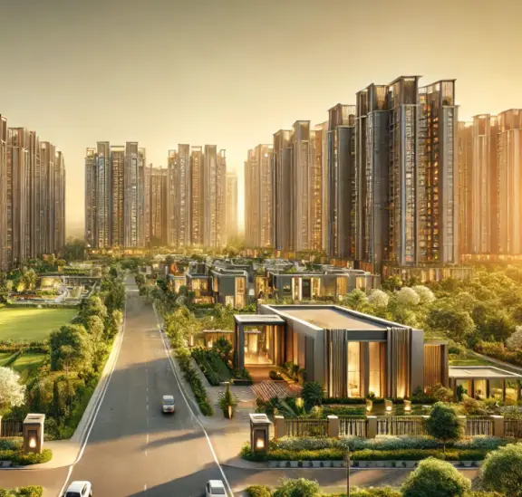
AISHWARYA PRIDE KVR s PHASE I
SIRI MAHALAXMI INFRA DEVELOPERS · Nalgonda · RERA P01800011216
AISHWARYA PRIDE KVR s PHASE I is a plotted development at Vinjamoor, Chinthapally mandal, Nalgonda district. The registered promoter is SIRI MAHALAXMI INFRA DEVELOPERS. The layout has a total area of 17,643.95 sq.m and shows 50 plots, with plot sizes of 125.28–355.66 sq.m; no tower or floor configuration is disclosed. It is registered under TG-RERA number P01800011216, with a proposed completion date of 14/06/2029.
More from Siri Mahalaxmi Infra Developers · 2 projects →
01What we found
Read from TG-RERA filings, approvals, land and registration records and court records. A court case is counted only when the court record states this project's survey number with its village, or names the project.
02Check before you pay
9 items to check before you pay, 4 high - from the title chain, court records and approvals, each with what to ask the builder or your advocate. An item may not be a problem with the project: records can be incomplete.
1. Project at a glance
Project identity
| Item | Record |
|---|---|
| Registered project name | AISHWARYA PRIDE KVR s PHASE I RERA record |
| Project type | Plotted development / open-plot layout RERA record RERA filing |
| Phase / registered portion | Phase I; the registration is for this phase. The supplied record does not describe other phases. RERA record |
| TG-RERA registration | P01800011216 RERA record |
| Registration validity | 15/06/2026–14/06/2029; registration validity is not itself proof of completion or occupancy. Approvals record |
| Registered promoter | SIRI MAHALAXMI INFRA DEVELOPERS RERA record Corporate record |
| RERA status | The supplied certificate records registration under section 5. |
Land and geographic identity
| Item | Record |
|---|---|
| Locality / revenue village | Vinjamoor (also rendered “Vinjamur” in the filed layout materials); revenue village stated as Vinjamoor. RERA record RERA filing |
| Mandal | Chinthapally (also rendered “Chintha Pally” / “Chinthapally”). RERA record RERA filing |
| District / PIN | Nalgonda / 508250 RERA record |
| All project survey numbers and subdivisions | 832/2/1, 833/2/6, 833/2/7, 834/2/2, 834/5, 832/2/2/1, 832/2/3, 832/2/2, 833/2/1, 833/2/2, 833/2/3, 833/2/4/1, 833/2/5 RERA filing |
| Survey references shown on layout drawing | 832/PART, 833/PART and 834/PART; the filed registration certificate separately lists the survey numbers and subdivisions above. |
| Total / registered site extent | 17,643.95 sq.m total layout area; 15,625.05 sq.m net layout area. RERA filing |
| Road-affected area | 2,018.9 sq.m RERA filing |
| Boundaries in RERA filing | East: “MAIN ROAD 10M EXISTING ROAD WIDTH 30 M PROPOSED RD”; west: neighbours open land; north: neighbours land; south: “10M MAIN INTERNAL APPROACH ROAD.” RERA filing |
Development identity
| Item | Record |
|---|---|
| Sanctioning authority | Hyderabad Metropolitan Development Authority (HMDA) Approvals record |
| Principal layout approval | 1380/HMDA/SWDL/2026, dated 15/06/2026; file number 017314/HMDA/04419/SWDL/SHZ/2026. Approvals record |
| Proceedings / permit reference also shown | 2221/HMDA/SWDL/2026; the filed draft layout letter identifies this as the layout permit/proceedings reference. Approvals record |
| Approved built-up area | 7,214.36 sq.m, as recorded in the project filing. RERA filing |
| Buildings / floors | Not applicable as a plotted-layout offering; no tower count or building-floor configuration is disclosed in the supplied project record. RERA record |
| Layout plots | 50 plots, as shown on the layout plan. Layout record |
| Parking provision | The layout area statement records 0.00 sq.m common parking area. No count of individual plot parking spaces is supplied. |
| Mortgaged plots | Plots 27, 41, 42, 43, 49 and 50, stated as 1,177.48 sq.m in favour of the Metropolitan Commissioner, HMDA. |
Offering and status
| Item | Record |
|---|---|
| Offering | Plots in a plotted layout; the supplied layout schedule contains 50 plots. RERA filing Layout record |
| Plot-size range | Software-measured from the layout drawing: 125.28–355.66 sq.m (software-extracted schedule; verify against the drawing). Layout record |
| Booked / available counts | Not disclosed in the supplied material. |
| Construction / development stage | No independently verified site-progress report is supplied. The HMDA filed letter requires layout development works and final-layout release steps; the registration certificate’s validity does not establish progress. |
| Completion deadline | Promoter’s Form B undertaking: 14/06/2029. |
| Original / revised completion dates | Only the stated completion undertaking is supplied; no revision or extension is recorded in the supplied certificate. |
| Occupancy / completion certificate | No occupancy or completion certificate is supplied for the plotted layout. |
2. The project story
AISHWARYA PRIDE KVR s PHASE I is registered as a plotted development at Vinjamoor village, Chinthapally mandal, Nalgonda district. The filed layout drawing describes 50 open plots arranged within a net layout area of 15,625.05 sq.m, with the wider site area recorded as 17,643.95 sq.m, including 2,018.9 sq.m affected by road widening. RERA record
The layout plan allocates land to plots, roads, open space, social infrastructure, utilities and a green belt. The HMDA filing also describes required development works such as road formation, drainage, internal water lines, power and street lighting, park development and rainwater-harvesting pits. These are approval-condition requirements, not evidence that the works are complete. No independently verified construction-progress or completion evidence is supplied.
3. Master plan, architecture & building design
This is a land layout rather than a tower or apartment scheme. The layout plan records 17,643.95 sq.m total site area, 15,625.05 sq.m net layout area and 2,018.9 sq.m road-widening area. The plan’s land-use schedule for the net area is:
| Layout use | Area | Share shown on plan |
|---|---|---|
| Plotted area | 7,214.36 sq.m | 46.17% |
| Roads | 4,779.02 sq.m | 30.59% |
| Open space | 1,174.89 sq.m | 7.52% |
| Social infrastructure | 392.34 sq.m | 2.51% |
| Utilities | 77.33 sq.m | 0.49% |
| Green belt | 1,987.13 sq.m | 12.72% |
The layout drawing shows 50 plots. Its schedule was software-read and should be checked against the drawing: 12 plots are in the 100–150 sq.yd band, 31 in the 150–200 sq.yd band, three in the 200–250 sq.yd band, three in the 250–300 sq.yd band, and one in the 400–500 sq.yd band. The software-measured smallest, median and largest plot areas are 125.28 sq.m, 125.42 sq.m and 355.66 sq.m, respectively. Layout record
The supplied plan does not establish apartment floor areas, building heights, tower arrangement or residential building-floor configuration. It identifies internal roads and walking/cycling circulation features and allocates land for open space and utilities.
4. Homes, configurations & floor plans
The registered offering is plots, not apartments. No RERA-filed unit-type table, booked/available inventory count or plot-wise saleable-area schedule is supplied. The layout drawing’s plot count and size bands are software-extracted, not a substitute for a verified plot schedule. RERA record Layout record
| Configuration | Units | Booked | Available | RERA saleable area | Measured carpet area | Loading (if supplied) |
|---|---|---|---|---|---|---|
| Plots | 50 plots shown on layout | Not disclosed | Not disclosed | Not disclosed | Not applicable | Not disclosed |
The only supplied drawing is a layout sheet; the floor-plan review records no apartment floor plans. Accordingly, apartment carpet area, room dimensions and common-area loading are not applicable or established by the supplied evidence. Floor plans Layout record
5. Parking & vehicle circulation
The layout area statement records 0.00 sq.m common parking area. No sanctioned count of plot-level parking spaces, visitor spaces or accessible spaces is supplied, and no individual parking allocation or exclusive ownership documentation is provided.
The filed HMDA conditions refer to roads, footpaths and cycling tracks and require parking areas in buildings to provide EV-charging infrastructure where applicable; the supplied material does not establish a parking facility or EV-charging installation delivered within this plotted layout.
6. Amenities, recreation & open spaces
The layout plan identifies land for open space, social infrastructure, utilities and a green belt. The HMDA letter lists required layout works and facilities; the supplied records do not verify their completion.
| Description / size | 1,174.89 sq.m; 7.52% of net layout area |
|---|---|
| Evidence source | HMDA layout plan |
| Declared progress / verified status | Area shown on plan; development and handover are conditions; completion not independently verified. |
| Description / size | 1,987.13 sq.m; 12.72% of net layout area |
|---|---|
| Evidence source | HMDA layout plan |
| Declared progress / verified status | Area shown on plan; planting and maintenance are required; completion not independently verified. |
| Description / size | 392.34 sq.m; 2.51% of net layout area |
|---|---|
| Evidence source | HMDA layout plan |
| Declared progress / verified status | Area shown on plan; handover is required before final layout release; completion not independently verified. |
| Description / size | Required within the layout; no size supplied |
|---|---|
| Evidence source | HMDA draft layout conditions |
| Declared progress / verified status | Required condition; completion not verified. |
| Description / size | The layout approval conditions require a fenced tot-lot maintained as greenery; no size supplied |
|---|---|
| Evidence source | HMDA layout approval conditions |
| Declared progress / verified status | Required condition; completion not verified. |
| Description / size | Not disclosed as a defined facility; no area or capacity supplied |
|---|---|
| Evidence source | RERA amenity disclosure RERA amenities |
| Declared progress / verified status | No progress or completion evidence supplied. |
7. Utilities, building services & safety
The filed HMDA layout conditions specify infrastructure to be provided, but the supplied evidence does not establish that these works are complete or independently tested.
| Evidence in the record | Required protected water supply, internal water-supply pipelines, overhead tank and sumps; the applicant is directed to arrange connectivity to Mission Bhagiratha or another authority-approved source. No capacity or completed source is supplied. |
|---|---|
| Status indicated | Approval-condition requirements; completion not verified. |
| Evidence in the record | Required underground drainage/storm-water systems and an independent sewerage-disposal mechanism; the letter refers to a common septic tank/STP and septage treatment arrangements. No capacity or operating evidence is supplied. |
|---|---|
| Status indicated | Approval-condition requirements; completion not verified. |
| Evidence in the record | Rainwater-harvesting pits / percolation structures are specified. |
|---|---|
| Status indicated | Required; completion not verified. |
| Evidence in the record | Required electrical supply lines, transformer, underground utility ducting and LED street lighting. |
|---|---|
| Status indicated | Required; completion not verified. |
| Evidence in the record | The HMDA conditions specify solid-waste disposal space, source segregation and a bio-compost unit. |
|---|---|
| Status indicated | Required; completion not verified. |
| Evidence in the record | The supplied layout materials do not establish a project-wide fire-service installation, CCTV system, staffed security or accessible route provision. Applicable approval conditions refer to safety requirements; no completion certificates are supplied. |
|---|---|
| Status indicated | Not verified. |
8. Location, access & connectivity
The official project location in the supplied record is Vinjamoor village, Chinthapally mandal, Nalgonda district, PIN 508250. The cadastral parcel centroid is recorded as 16.83827, 78.80340. RERA record RERA filing Cadastral map
The RERA-filed boundaries identify a main road on the east, neighbours’ open land to the west, neighbours’ land to the north and a 10 m main internal approach road to the south. The layout plan lists road widths including 9.14 m, 10.06 m, 10 m, 10.07 m, 12.2 m, 30.48 m and 30'-0". RERA filing
The supplied location data records Sub Centre, Vinjamoor — 2.0 km and the nearest sampled Outer Ring Road interchange at approximately 52.2 km. These are location-data measurements, not promoter travel-time claims. Location record
9. Developer & development status
The registered promoter is SIRI MAHALAXMI INFRA DEVELOPERS, identified in the RERA filing as a partnership. The supplied corporate identifier is GSTIN 36AFAFS1295N1ZJ. The registration certificate gives the promoter office as Village: Nagole, Mandal: Uppal, District: Medchal-Malkajgiri, Pin: 500068. Corporate record RERA filing
The project Form B records the promoter’s undertaking to complete by 14/06/2029 and its declarations concerning title, encumbrances, project funds and timely pending approvals. These are promoter declarations, not independent verification of title or progress.
10. Approvals, official records & documents
| Identifier / date | P01800011216; issued 07/09/2026; valid 15/06/2026–14/06/2029 |
|---|---|
| What the supplied record establishes | Form C certificate for AISHWARYA PRIDE KVR s PHASE I. |
| Identifier / date | Approval 1380/HMDA/SWDL/2026; 15/06/2026; file 017314/HMDA/04419/SWDL/SHZ/2026 |
|---|---|
| What the supplied record establishes | Layout drawing for a 50-plot development, with land-use allocation and site-area figures. |
| Identifier / date | 2221/HMDA/SWDL/2026; 15/06/2026 |
|---|---|
| What the supplied record establishes | Sets out draft-layout development and handover conditions, including release of the final layout after required works and local-body handovers. |
| Identifier / date | Mortgage deed 4916/2026, dated 08/06/2026 |
|---|---|
| What the supplied record establishes | Identifies plots 27, 41, 42, 43, 49 and 50, totalling 1,177.48 sq.m, mortgaged to HMDA. |
| Identifier / date | Gift deed 4915/2026, dated 08/06/2026 |
|---|---|
| What the supplied record establishes | Records handover of 2,018.9 sq.m road-affected area to the local body. |
| Identifier / date | Form B, filed for the project |
|---|---|
| What the supplied record establishes | Promoter’s declarations and completion undertaking of 14/06/2029. |
| Identifier / date | Not supplied |
|---|---|
| What the supplied record establishes | No occupancy or completion certificate for the plotted layout is present in the supplied material. |
The supplied evidence includes layout approval materials and a RERA registration certificate; it does not include a completion certificate, occupancy certificate or independent report confirming completion of the specified layout works. Document index
1. Project at a glance
Project identity
Registered project name: AISHWARYA PRIDE KVR s PHASE I
Project type: Plotted development / open-plot layout
Phase / registered portion: Phase I; the registration is for this phase. The supplied record does not describe other phases.
TG-RERA registration: P01800011216
Registration validity: 15/06/2026–14/06/2029; registration validity is not itself proof of completion or occupancy.
Registered promoter: SIRI MAHALAXMI INFRA DEVELOPERS
RERA status: The supplied certificate records registration under section 5.
Land and geographic identity
Locality / revenue village: Vinjamoor (also rendered “Vinjamur” in the filed layout materials); revenue village stated as Vinjamoor.
Mandal: Chinthapally (also rendered “Chintha Pally” / “Chinthapally”).
District / PIN: Nalgonda / 508250
All project survey numbers and subdivisions: 832/2/1, 833/2/6, 833/2/7, 834/2/2, 834/5, 832/2/2/1, 832/2/3, 832/2/2, 833/2/1, 833/2/2, 833/2/3, 833/2/4/1, 833/2/5
Survey references shown on layout drawing: 832/PART, 833/PART and 834/PART; the filed registration certificate separately lists the survey numbers and subdivisions above.
Total / registered site extent: 17,643.95 sq.m total layout area; 15,625.05 sq.m net layout area.
Road-affected area: 2,018.9 sq.m
Boundaries in RERA filing: East: “MAIN ROAD 10M EXISTING ROAD WIDTH 30 M PROPOSED RD”; west: neighbours open land; north: neighbours land; south: “10M MAIN INTERNAL APPROACH ROAD.”
Development identity
Sanctioning authority: Hyderabad Metropolitan Development Authority (HMDA)
Principal layout approval: 1380/HMDA/SWDL/2026, dated 15/06/2026; file number 017314/HMDA/04419/SWDL/SHZ/2026.
Proceedings / permit reference also shown: 2221/HMDA/SWDL/2026; the filed draft layout letter identifies this as the layout permit/proceedings reference.
Approved built-up area: 7,214.36 sq.m, as recorded in the project filing.
Buildings / floors: Not applicable as a plotted-layout offering; no tower count or building-floor configuration is disclosed in the supplied project record.
Layout plots: 50 plots, as shown on the layout plan.
Parking provision: The layout area statement records 0.00 sq.m common parking area. No count of individual plot parking spaces is supplied.
Mortgaged plots: Plots 27, 41, 42, 43, 49 and 50, stated as 1,177.48 sq.m in favour of the Metropolitan Commissioner, HMDA.
Offering and status
Offering: Plots in a plotted layout; the supplied layout schedule contains 50 plots.
Plot-size range: Software-measured from the layout drawing: 125.28–355.66 sq.m (software-extracted schedule; verify against the drawing).
Booked / available counts: Not disclosed in the supplied material.
Construction / development stage: No independently verified site-progress report is supplied. The HMDA filed letter requires layout development works and final-layout release steps; the registration certificate’s validity does not establish progress.
Completion deadline: Promoter’s Form B undertaking: 14/06/2029.
Original / revised completion dates: Only the stated completion undertaking is supplied; no revision or extension is recorded in the supplied certificate.
Occupancy / completion certificate: No occupancy or completion certificate is supplied for the plotted layout.
2. The project story
AISHWARYA PRIDE KVR s PHASE I is registered as a plotted development at Vinjamoor village, Chinthapally mandal, Nalgonda district. The filed layout drawing describes 50 open plots arranged within a net layout area of 15,625.05 sq.m, with the wider site area recorded as 17,643.95 sq.m, including 2,018.9 sq.m affected by road widening.
The layout plan allocates land to plots, roads, open space, social infrastructure, utilities and a green belt. The HMDA filing also describes required development works such as road formation, drainage, internal water lines, power and street lighting, park development and rainwater-harvesting pits. These are approval-condition requirements, not evidence that the works are complete. No independently verified construction-progress or completion evidence is supplied.
3. Master plan, architecture & building design
This is a land layout rather than a tower or apartment scheme. The layout plan records 17,643.95 sq.m total site area, 15,625.05 sq.m net layout area and 2,018.9 sq.m road-widening area. The plan’s land-use schedule for the net area is:
| Layout use | Area | Share shown on plan |
|---|---|---|
| Plotted area | 7,214.36 sq.m | 46.17% |
| Roads | 4,779.02 sq.m | 30.59% |
| Open space | 1,174.89 sq.m | 7.52% |
| Social infrastructure | 392.34 sq.m | 2.51% |
| Utilities | 77.33 sq.m | 0.49% |
| Green belt | 1,987.13 sq.m | 12.72% |
The layout drawing shows 50 plots. Its schedule was software-read and should be checked against the drawing: 12 plots are in the 100–150 sq.yd band, 31 in the 150–200 sq.yd band, three in the 200–250 sq.yd band, three in the 250–300 sq.yd band, and one in the 400–500 sq.yd band. The software-measured smallest, median and largest plot areas are 125.28 sq.m, 125.42 sq.m and 355.66 sq.m, respectively.
The supplied plan does not establish apartment floor areas, building heights, tower arrangement or residential building-floor configuration. It identifies internal roads and walking/cycling circulation features and allocates land for open space and utilities.
4. Homes, configurations & floor plans
The registered offering is plots, not apartments. No RERA-filed unit-type table, booked/available inventory count or plot-wise saleable-area schedule is supplied. The layout drawing’s plot count and size bands are software-extracted, not a substitute for a verified plot schedule.
| Configuration | Units | Booked | Available | RERA saleable area | Measured carpet area | Loading (if supplied) |
|---|---|---|---|---|---|---|
| Plots | 50 plots shown on layout | Not disclosed | Not disclosed | Not disclosed | Not applicable | Not disclosed |
The only supplied drawing is a layout sheet; the floor-plan review records no apartment floor plans. Accordingly, apartment carpet area, room dimensions and common-area loading are not applicable or established by the supplied evidence.
5. Parking & vehicle circulation
The layout area statement records 0.00 sq.m common parking area. No sanctioned count of plot-level parking spaces, visitor spaces or accessible spaces is supplied, and no individual parking allocation or exclusive ownership documentation is provided.
The filed HMDA conditions refer to roads, footpaths and cycling tracks and require parking areas in buildings to provide EV-charging infrastructure where applicable; the supplied material does not establish a parking facility or EV-charging installation delivered within this plotted layout.
6. Amenities, recreation & open spaces
The layout plan identifies land for open space, social infrastructure, utilities and a green belt. The HMDA letter lists required layout works and facilities; the supplied records do not verify their completion.
| Description / size | 1,174.89 sq.m; 7.52% of net layout area |
|---|---|
| Evidence source | HMDA layout plan |
| Declared progress / verified status | Area shown on plan; development and handover are conditions; completion not independently verified. |
| Description / size | 1,987.13 sq.m; 12.72% of net layout area |
|---|---|
| Evidence source | HMDA layout plan |
| Declared progress / verified status | Area shown on plan; planting and maintenance are required; completion not independently verified. |
| Description / size | 392.34 sq.m; 2.51% of net layout area |
|---|---|
| Evidence source | HMDA layout plan |
| Declared progress / verified status | Area shown on plan; handover is required before final layout release; completion not independently verified. |
| Description / size | Required within the layout; no size supplied |
|---|---|
| Evidence source | HMDA draft layout conditions |
| Declared progress / verified status | Required condition; completion not verified. |
| Description / size | The layout approval conditions require a fenced tot-lot maintained as greenery; no size supplied |
|---|---|
| Evidence source | HMDA layout approval conditions |
| Declared progress / verified status | Required condition; completion not verified. |
| Description / size | Not disclosed as a defined facility; no area or capacity supplied |
|---|---|
| Evidence source | RERA amenity disclosure |
| Declared progress / verified status | No progress or completion evidence supplied. |
7. Utilities, building services & safety
The filed HMDA layout conditions specify infrastructure to be provided, but the supplied evidence does not establish that these works are complete or independently tested.
| Evidence in the record | Required protected water supply, internal water-supply pipelines, overhead tank and sumps; the applicant is directed to arrange connectivity to Mission Bhagiratha or another authority-approved source. No capacity or completed source is supplied. |
|---|---|
| Status indicated | Approval-condition requirements; completion not verified. |
| Evidence in the record | Required underground drainage/storm-water systems and an independent sewerage-disposal mechanism; the letter refers to a common septic tank/STP and septage treatment arrangements. No capacity or operating evidence is supplied. |
|---|---|
| Status indicated | Approval-condition requirements; completion not verified. |
| Evidence in the record | Rainwater-harvesting pits / percolation structures are specified. |
|---|---|
| Status indicated | Required; completion not verified. |
| Evidence in the record | Required electrical supply lines, transformer, underground utility ducting and LED street lighting. |
|---|---|
| Status indicated | Required; completion not verified. |
| Evidence in the record | The HMDA conditions specify solid-waste disposal space, source segregation and a bio-compost unit. |
|---|---|
| Status indicated | Required; completion not verified. |
| Evidence in the record | The supplied layout materials do not establish a project-wide fire-service installation, CCTV system, staffed security or accessible route provision. Applicable approval conditions refer to safety requirements; no completion certificates are supplied. |
|---|---|
| Status indicated | Not verified. |
8. Location, access & connectivity
The official project location in the supplied record is Vinjamoor village, Chinthapally mandal, Nalgonda district, PIN 508250. The cadastral parcel centroid is recorded as 16.83827, 78.80340.
The RERA-filed boundaries identify a main road on the east, neighbours’ open land to the west, neighbours’ land to the north and a 10 m main internal approach road to the south. The layout plan lists road widths including 9.14 m, 10.06 m, 10 m, 10.07 m, 12.2 m, 30.48 m and 30'-0".
The supplied location data records Sub Centre, Vinjamoor — 2.0 km and the nearest sampled Outer Ring Road interchange at approximately 52.2 km. These are location-data measurements, not promoter travel-time claims.
9. Developer & development status
The registered promoter is SIRI MAHALAXMI INFRA DEVELOPERS, identified in the RERA filing as a partnership. The supplied corporate identifier is GSTIN 36AFAFS1295N1ZJ. The registration certificate gives the promoter office as Village: Nagole, Mandal: Uppal, District: Medchal-Malkajgiri, Pin: 500068.
The project Form B records the promoter’s undertaking to complete by 14/06/2029 and its declarations concerning title, encumbrances, project funds and timely pending approvals. These are promoter declarations, not independent verification of title or progress.
10. Approvals, official records & documents
| Identifier / date | P01800011216; issued 07/09/2026; valid 15/06/2026–14/06/2029 |
|---|---|
| What the supplied record establishes | Form C certificate for AISHWARYA PRIDE KVR s PHASE I. |
| Identifier / date | Approval 1380/HMDA/SWDL/2026; 15/06/2026; file 017314/HMDA/04419/SWDL/SHZ/2026 |
|---|---|
| What the supplied record establishes | Layout drawing for a 50-plot development, with land-use allocation and site-area figures. |
| Identifier / date | 2221/HMDA/SWDL/2026; 15/06/2026 |
|---|---|
| What the supplied record establishes | Sets out draft-layout development and handover conditions, including release of the final layout after required works and local-body handovers. |
| Identifier / date | Mortgage deed 4916/2026, dated 08/06/2026 |
|---|---|
| What the supplied record establishes | Identifies plots 27, 41, 42, 43, 49 and 50, totalling 1,177.48 sq.m, mortgaged to HMDA. |
| Identifier / date | Gift deed 4915/2026, dated 08/06/2026 |
|---|---|
| What the supplied record establishes | Records handover of 2,018.9 sq.m road-affected area to the local body. |
| Identifier / date | Form B, filed for the project |
|---|---|
| What the supplied record establishes | Promoter’s declarations and completion undertaking of 14/06/2029. |
| Identifier / date | Not supplied |
|---|---|
| What the supplied record establishes | No occupancy or completion certificate for the plotted layout is present in the supplied material. |
The supplied evidence includes layout approval materials and a RERA registration certificate; it does not include a completion certificate, occupancy certificate or independent report confirming completion of the specified layout works.
Other registrations of AISHWARYA PRIDE KVR s
Frequently asked questions
Is AISHWARYA PRIDE KVR s PHASE I registered with Telangana RERA?
Yes. AISHWARYA PRIDE KVR s PHASE I is registered with the Telangana Real Estate Regulatory Authority as P01800011216; the registration status is New Project.
Who is the developer of AISHWARYA PRIDE KVR s PHASE I?
The promoter named in the RERA registration is SIRI MAHALAXMI INFRA DEVELOPERS.
Where is AISHWARYA PRIDE KVR s PHASE I located?
AISHWARYA PRIDE KVR s PHASE I is in CHINTHA PALLY MANDAL, Vinjamoor, Chinthapally, Nalgonda, Telangana (508250).
When will AISHWARYA PRIDE KVR s PHASE I be completed?
The promoter's proposed date of completion filed with RERA is 14/06/2029. This is the promoter's declaration, not a guarantee.
More projects in Vinjamoor