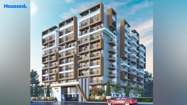
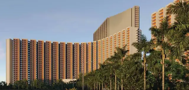
Lakshmi Sri Ratnagarbha
LAKSHMI SRI DEVELOPERS AND BUILDERS · Sangareddy · RERA P01100011221
LAKSHMI SRI RATNAGARBHA is a plotted development in PATANCHERU A, Patancheru Mandal, Sangareddy District. The registered promoter is LAKSHMI SRI DEVELOPERS AND BUILDERS. The RERA filing records a site area of 112857.7 sq.m; the HMDA plan lists 409 plots, and the project offers plots. The project is registered under TG-RERA number P01100011221, with a proposed completion date of 26.09.2028.
01What we found
Read from TG-RERA filings, approvals, land and registration records and court records. A court case is counted only when the court record states this project's survey number with its village, or names the project.
02Check before you pay
12 items to check before you pay, 7 high - from the title chain, court records and approvals, each with what to ask the builder or your advocate. An item may not be a problem with the project: records can be incomplete.
1. Project at a glance
Project identity
| Item | Project record |
|---|---|
| Registered project name | LAKSHMI SRI RATNAGARBHA RERA record |
| Project type / registered portion | Plotted development; registered project portion is not separately named in the supplied record. RERA record RERA filing |
| TG-RERA registration | P01100011221 RERA record |
| Registration validity | 26 September 2025 to 26 September 2028. This is the registration period, not evidence of completion or occupancy. RERA record |
| Registered promoter | LAKSHMI SRI DEVELOPERS AND BUILDERS; the registration certificate identifies it as represented by Giri Prasad Miriyala and others. RERA record |
| RERA status | New project; TG-RERA registration certificate supplied. RERA record |
Land and geographic identity
| Item | Project record |
|---|---|
| Locality / revenue village | PATANCHERU A in the project identity and RERA filing; the HMDA draft-layout documents describe the site as Bachuguda Village. RERA record RERA filing |
| Mandal / district / PIN | PATANCHERU, Sangareddy, 502300 in the project filing and registration certificate. RERA record RERA filing |
| Project survey numbers and subdivisions | 40, 51/P, 53, 54, 55, 57/P, 64, 65, 66, 80/P, 89, 91, 92/P, 93, 94/P, 96/P, 97, 98/P, 100, 101/P, 105/P, 106 and 266. The HMDA plan extraction also lists 83 and 95; their relationship to the registered project survey schedule is not established in this Overview. RERA record RERA filing |
| Registered site area | RERA filing: 112857.7 sq.m total and net area. RERA filing |
| Layout drawing area | HMDA draft-layout records state Total Layout Area 112962.2 sq.m and Net Layout Area 112857.7 sq.m, with Road Widening Area 104.5 sq.m. |
| Boundaries | East, west, north and south are each recorded as OTHERS LAND. RERA filing |
Development identity
| Item | Project record |
|---|---|
| Sanctioning authority / principal layout reference | HMDA; layout approval number 0681/HMDA/SWDL/2025, dated 14/05/2025 in the supplied approval record. RERA record Approvals record |
| Related file / application reference | 001044/HMDA/00245/SWDL/SKP2/2025. The supplied HMDA letters describe draft layout permission/technical approval; final layout release is not evidenced here. Approvals record |
| Approved built-up area | 69,869.41 sq.m recorded in the RERA filing. The supplied project is a plotted layout; no building count or floor configuration is disclosed. RERA filing |
| Mortgage area | 14,214.18 sq.m recorded in the RERA filing. The HMDA draft-layout letter identifies mortgaged plots in favour of the Metropolitan Commissioner, HMDA. RERA filing |
| Plot count | 409 plots stated in the HMDA plan extraction. |
| Buildings / floors / parking levels | Not disclosed as a building or apartment project; no tower, floor, basement, stilt or parking-level count is supplied. RERA record |
Offering and status
| Item | Project record |
|---|---|
| Offered product | Plots in a plotted layout. RERA record RERA filing |
| RERA unit count / RERA saleable-area schedule | Unit-type counts and RERA-filed plot-by-plot saleable areas are not included in the supplied data. RERA filing |
| Drawing-derived plot schedule | The layout analysis reports 408 plots, with printed plot numbers and areas; this is software-read from the drawing and should be checked against the plan. Layout record |
| Construction / development status | RERA filing describes a New Project. A promoter marketing entry calls it under construction, but independently verified site progress is not supplied. RERA filing Promoter website |
| Completion deadline | Promoter’s Form B declaration states 26.09.2028. This is the declared completion date, distinct from the registration-validity period. |
| Occupancy / completion certificate | No occupancy certificate or completion certificate is supplied. The HMDA letters refer to final layout release and required development works; they do not establish an OC. |
2. The project story
LAKSHMI SRI RATNAGARBHA is registered as a plotted-development project by LAKSHMI SRI DEVELOPERS AND BUILDERS. The RERA filing locates it at PATANCHERU A, Patancheru Mandal, Sangareddy District, and identifies the survey schedule shown above. HMDA draft-layout records describe the site as Bachuguda Village and state that the permission is for a plotted layout. RERA record RERA filing
The filed completion undertaking is 26 September 2028. The evidence supplied does not include independently verified construction progress, a final layout-release order, or an occupancy/completion certificate. The HMDA draft-layout material describes infrastructure and handover steps associated with final layout release; these are not evidence that those works have been completed.
3. Master plan, architecture & building design
This is a land subdivision rather than a multi-storey residential building. The HMDA draft-layout plan extraction records a total layout area of 112962.2 sq.m, net layout area of 112857.7 sq.m, and road-widening area of 104.5 sq.m. It lists 409 plots; the separate software reading of the plan identifies 408 plots and reads plot numbers and printed areas. The software-derived count and plot areas should be verified against the drawing. Layout record
The layout’s printed land-use statement allocates 69,869.41 sq.m (61.91%) to plotted area, 31,051.07 sq.m (27.51%) to roads, 8,467.20 sq.m (7.50%) to open space, 2,822.25 sq.m (2.50%) to social infrastructure and 647.79 sq.m (0.57%) to utilities. The plan also records 0.00 sq.m for buffer area, common parking area and green-belt area in that land-use table.
The plan lists internal and approach-road widths including 9m, 9.01m, 9.74m, 10m and 12m, and references a 30m proposed road width. The detailed road network and individual plot geometry are shown in the layout drawing; no building footprints, floor plans or building-height information is provided.
The HMDA draft-layout records name parks/open spaces, social infrastructure, utilities and public utility areas, and identify infrastructure elements such as internal water lines, overhead tank, storm-water drains, underground drainage, electrical lines, street lights and park development. These are described as planned or required layout works, not independently verified completed facilities.
4. Homes, configurations & floor plans
The project offers plots, not apartments. A RERA-filed plot-by-plot unit schedule is not included in the supplied evidence. The software analysis of the layout drawing reports 408 plots with printed areas, with sizes from 125.59 sq.m (150.2 sq.yd) to 592.17 sq.m (708.2 sq.yd) and a median of 139.37 sq.m (166.7 sq.yd). These are software-measured readings from drawing text, not a RERA-filed saleable-area schedule. Layout record
| Plot-size band (as read from drawing) | Plots |
|---|---|
| 150–200 sq.yd (125–167 sq.m) | 287 |
| 200–250 sq.yd (167–209 sq.m) | 76 |
| 250–300 sq.yd (209–251 sq.m) | 4 |
| 300–400 sq.yd (251–334 sq.m) | 36 |
| 400–500 sq.yd (334–418 sq.m) | 4 |
| 500–1000 sq.yd (418–836 sq.m) | 1 |
The largest and smallest plot readings, bands and common printed plot areas are drawing-based measurements and should be confirmed against the approved drawing and the specific plot’s registered documents. Apartment carpet-area, balcony, common-area loading and saleable-area comparisons are not applicable to this plotted offering. Layout record Floor plans
5. Parking & vehicle circulation
The supplied layout land-use statement records 0.00 sq.m as common parking area. The HMDA plan’s conditions address parking for buildings, but do not provide a project-wide count of parking spaces for this plotted layout. No resident/visitor parking allocation, individual plot parking entitlement, parking facility or EV-charging facility for the layout is established by the supplied evidence.
The layout material lists internal roads and approach-road widths, but does not establish a separate pedestrian-only network or a plot-specific driveway arrangement. A drawn road or bay should not be treated as an exclusive parking entitlement.
6. Amenities, recreation & open spaces
The project material identifies planned layout-level facilities and open areas. No independent completion verification is supplied; the progress fields in the RERA amenities data show 0% where percentages are recorded. RERA amenities
| Description / size | 8,467.20 sq.m (7.50%) aggregate organized open-space/park area in the HMDA draft-layout record. |
|---|---|
| Evidence source | HMDA draft-layout record |
| Declared progress / verified status | Handover and development are conditions/requirements; completion not verified. |
| Description / size | Tot-lot and park development are identified in the plan/conditions; no facility-specific size or capacity is supplied. |
|---|---|
| Evidence source | HMDA plan and draft-layout record |
| Declared progress / verified status | Required/planned; completion not verified. |
| Description / size | 2,822.25 sq.m (2.50%). |
|---|---|
| Evidence source | HMDA draft-layout record |
| Declared progress / verified status | Handover to the local body is required before final layout release; completion not verified. |
| Description / size | Named in the draft-layout infrastructure list; no length or separate area is stated. |
|---|---|
| Evidence source | HMDA draft-layout record |
| Declared progress / verified status | Planned/listed; completion not verified. |
| Description / size | Utility land totals 647.79 sq.m (0.57%) in the HMDA land-use schedule. |
|---|---|
| Evidence source | HMDA draft-layout record |
| Declared progress / verified status | Handover to the local body is required before final layout release; completion not verified. |
The vendor-supplied marketing amenity list includes park, rainwater harvesting, water storage, waste disposal, CCTV camera, fire sprinklers and entry/exit gate. These are marketing claims, not evidence of sanction or delivery; the project evidence does not establish their dimensions, capacities or completion. Promoter website
7. Utilities, building services & safety
HMDA’s draft-layout material lists proposed/required infrastructure including potable-water connectivity and internal water-supply lines, an overhead tank, storm-water drains, underground drainage, common septic tank/STP, electrical supply lines, transformer/transformer yard, street lighting, rainwater-harvesting pits, solid-waste handling and a bio-compost unit. The supplied documents do not give capacities or independently verify that these facilities are installed and operational.
The draft-layout conditions also refer to providing a transformer space, garbage house, rainwater-harvesting structure and TOT-lot. Fire-safety, lifts and building services provisions appear in the extracted conditions for building construction, but no building-specific systems, approvals or completed works are supplied for this plotted project.
8. Location, access & connectivity
The registered project location is PATANCHERU A, Patancheru Mandal, Sangareddy District, PIN 502300. The HMDA draft-layout records describe the land as Bachuguda Village and identify approach/internal roads in the layout, including listed widths of 9m, 9.01m, 9.74m, 10m and 12m, with a 30m proposed road width referenced in the plan extraction. RERA record RERA filing
The supplied location data gives these measured distances: Outer Ring Road nearest sampled interchange approximately 1.6 km; TGSRTC Bus Station, Patancheru 1.6 km; ICICI Bank 1.7 km; Government Degree College 1.3 km; People’s Hospital 1.3 km; Chaitanya High School 0.6 km; and an unnamed park 2.0 km. Location record
A separate vendor-provided connectivity list states distances to St Marys Group of Institutions College of Engineering Technology (2.5 Km), Oakdale International School (6.2 Km), Aryan School Of Excellence (1.5 Km), Patancheru Railway Station (2.7 Km) and Mahendra Shopping Centre (2.0 Km). These are vendor-supplied claims. Promoter website
9. Developer & development status
The registered legal promoter is LAKSHMI SRI DEVELOPERS AND BUILDERS, identified in the RERA filing as a Partnership. The filing gives GSTIN 36AAIFL4132G2ZG. The available RERA registration certificate states the promoter’s office as Village Ramchandrapuram, Mandal Ramchandrapuram, Sangareddy District, PIN 502032; no official website or promoter contact details are included in the supplied evidence. RERA record RERA filing Corporate record
The Form B declaration states that the promoter claims legal title to the project land, declares it free from encumbrances, and undertakes to complete by 26.09.2028. These are promoter declarations, not independent title or construction verification.
10. Approvals, official records & documents
| Supplied evidence | Form C certificate P01100011221, issued 15/09/2026; valid 26/09/2025–26/09/2028. |
|---|---|
| Overview significance | Confirms project registration and stated validity. |
| Supplied evidence | Draft Layout Letter, approval number 0681/HMDA/SWDL/2025, dated 14/05/2025; file/application 001044/HMDA/00245/SWDL/SKP2/2025. |
|---|---|
| Overview significance | Records draft layout technical approval and conditions. Final layout release is not evidenced in the supplied materials. |
| Supplied evidence | Proposed plotted-layout plan and land-use schedule for the listed survey land. |
|---|---|
| Overview significance | Drawing-based layout and area information. |
| Supplied evidence | Mortgage deed 21789/2025, dated 28/08/2025; listed mortgaged plots total 14,214.18 sq.m. |
|---|---|
| Overview significance | HMDA letter states the plots are mortgaged in favour of the Metropolitan Commissioner, HMDA and restricts their sale pending required release. |
| Supplied evidence | Gift deed 233359/2025, dated 22/09/2025, for 104.5 sq.m road-affected area. |
|---|---|
| Overview significance | The draft-layout letter records this as handed over. |
| Supplied evidence | Form B dated 27 February 2026. |
|---|---|
| Overview significance | Records promoter’s title, encumbrance, separate-account and completion declarations. |
| Supplied evidence | Not supplied. Document index |
|---|---|
| Overview significance | No OC or completion certificate status is established by the materials provided. |
1. Project at a glance
Project identity
Registered project name: LAKSHMI SRI RATNAGARBHA
Project type / registered portion: Plotted development; registered project portion is not separately named in the supplied record.
TG-RERA registration: P01100011221
Registration validity: 26 September 2025 to 26 September 2028. This is the registration period, not evidence of completion or occupancy.
Registered promoter: LAKSHMI SRI DEVELOPERS AND BUILDERS; the registration certificate identifies it as represented by Giri Prasad Miriyala and others.
RERA status: New project; TG-RERA registration certificate supplied.
Land and geographic identity
Locality / revenue village: PATANCHERU A in the project identity and RERA filing; the HMDA draft-layout documents describe the site as Bachuguda Village.
Mandal / district / PIN: PATANCHERU, Sangareddy, 502300 in the project filing and registration certificate.
Project survey numbers and subdivisions: 40, 51/P, 53, 54, 55, 57/P, 64, 65, 66, 80/P, 89, 91, 92/P, 93, 94/P, 96/P, 97, 98/P, 100, 101/P, 105/P, 106 and 266. The HMDA plan extraction also lists 83 and 95; their relationship to the registered project survey schedule is not established in this Overview.
Registered site area: RERA filing: 112857.7 sq.m total and net area.
Layout drawing area: HMDA draft-layout records state Total Layout Area 112962.2 sq.m and Net Layout Area 112857.7 sq.m, with Road Widening Area 104.5 sq.m.
Boundaries: East, west, north and south are each recorded as OTHERS LAND.
Development identity
Sanctioning authority / principal layout reference: HMDA; layout approval number 0681/HMDA/SWDL/2025, dated 14/05/2025 in the supplied approval record.
Related file / application reference: 001044/HMDA/00245/SWDL/SKP2/2025. The supplied HMDA letters describe draft layout permission/technical approval; final layout release is not evidenced here.
Approved built-up area: 69,869.41 sq.m recorded in the RERA filing. The supplied project is a plotted layout; no building count or floor configuration is disclosed.
Mortgage area: 14,214.18 sq.m recorded in the RERA filing. The HMDA draft-layout letter identifies mortgaged plots in favour of the Metropolitan Commissioner, HMDA.
Plot count: 409 plots stated in the HMDA plan extraction.
Buildings / floors / parking levels: Not disclosed as a building or apartment project; no tower, floor, basement, stilt or parking-level count is supplied.
Offering and status
Offered product: Plots in a plotted layout.
RERA unit count / RERA saleable-area schedule: Unit-type counts and RERA-filed plot-by-plot saleable areas are not included in the supplied data.
Drawing-derived plot schedule: The layout analysis reports 408 plots, with printed plot numbers and areas; this is software-read from the drawing and should be checked against the plan.
Construction / development status: RERA filing describes a New Project. A promoter marketing entry calls it under construction, but independently verified site progress is not supplied.
Completion deadline: Promoter’s Form B declaration states 26.09.2028. This is the declared completion date, distinct from the registration-validity period.
Occupancy / completion certificate: No occupancy certificate or completion certificate is supplied. The HMDA letters refer to final layout release and required development works; they do not establish an OC.
2. The project story
LAKSHMI SRI RATNAGARBHA is registered as a plotted-development project by LAKSHMI SRI DEVELOPERS AND BUILDERS. The RERA filing locates it at PATANCHERU A, Patancheru Mandal, Sangareddy District, and identifies the survey schedule shown above. HMDA draft-layout records describe the site as Bachuguda Village and state that the permission is for a plotted layout.
The filed completion undertaking is 26 September 2028. The evidence supplied does not include independently verified construction progress, a final layout-release order, or an occupancy/completion certificate. The HMDA draft-layout material describes infrastructure and handover steps associated with final layout release; these are not evidence that those works have been completed.
3. Master plan, architecture & building design
This is a land subdivision rather than a multi-storey residential building. The HMDA draft-layout plan extraction records a total layout area of 112962.2 sq.m, net layout area of 112857.7 sq.m, and road-widening area of 104.5 sq.m. It lists 409 plots; the separate software reading of the plan identifies 408 plots and reads plot numbers and printed areas. The software-derived count and plot areas should be verified against the drawing.
The layout’s printed land-use statement allocates 69,869.41 sq.m (61.91%) to plotted area, 31,051.07 sq.m (27.51%) to roads, 8,467.20 sq.m (7.50%) to open space, 2,822.25 sq.m (2.50%) to social infrastructure and 647.79 sq.m (0.57%) to utilities. The plan also records 0.00 sq.m for buffer area, common parking area and green-belt area in that land-use table.
The plan lists internal and approach-road widths including 9m, 9.01m, 9.74m, 10m and 12m, and references a 30m proposed road width. The detailed road network and individual plot geometry are shown in the layout drawing; no building footprints, floor plans or building-height information is provided.
The HMDA draft-layout records name parks/open spaces, social infrastructure, utilities and public utility areas, and identify infrastructure elements such as internal water lines, overhead tank, storm-water drains, underground drainage, electrical lines, street lights and park development. These are described as planned or required layout works, not independently verified completed facilities.
4. Homes, configurations & floor plans
The project offers plots, not apartments. A RERA-filed plot-by-plot unit schedule is not included in the supplied evidence. The software analysis of the layout drawing reports 408 plots with printed areas, with sizes from 125.59 sq.m (150.2 sq.yd) to 592.17 sq.m (708.2 sq.yd) and a median of 139.37 sq.m (166.7 sq.yd). These are software-measured readings from drawing text, not a RERA-filed saleable-area schedule.
150–200 sq.yd (125–167 sq.m): 287
200–250 sq.yd (167–209 sq.m): 76
250–300 sq.yd (209–251 sq.m): 4
300–400 sq.yd (251–334 sq.m): 36
400–500 sq.yd (334–418 sq.m): 4
500–1000 sq.yd (418–836 sq.m): 1
The largest and smallest plot readings, bands and common printed plot areas are drawing-based measurements and should be confirmed against the approved drawing and the specific plot’s registered documents. Apartment carpet-area, balcony, common-area loading and saleable-area comparisons are not applicable to this plotted offering.
5. Parking & vehicle circulation
The supplied layout land-use statement records 0.00 sq.m as common parking area. The HMDA plan’s conditions address parking for buildings, but do not provide a project-wide count of parking spaces for this plotted layout. No resident/visitor parking allocation, individual plot parking entitlement, parking facility or EV-charging facility for the layout is established by the supplied evidence.
The layout material lists internal roads and approach-road widths, but does not establish a separate pedestrian-only network or a plot-specific driveway arrangement. A drawn road or bay should not be treated as an exclusive parking entitlement.
6. Amenities, recreation & open spaces
The project material identifies planned layout-level facilities and open areas. No independent completion verification is supplied; the progress fields in the RERA amenities data show 0% where percentages are recorded.
| Description / size | 8,467.20 sq.m (7.50%) aggregate organized open-space/park area in the HMDA draft-layout record. |
|---|---|
| Evidence source | HMDA draft-layout record |
| Declared progress / verified status | Handover and development are conditions/requirements; completion not verified. |
| Description / size | Tot-lot and park development are identified in the plan/conditions; no facility-specific size or capacity is supplied. |
|---|---|
| Evidence source | HMDA plan and draft-layout record |
| Declared progress / verified status | Required/planned; completion not verified. |
| Description / size | 2,822.25 sq.m (2.50%). |
|---|---|
| Evidence source | HMDA draft-layout record |
| Declared progress / verified status | Handover to the local body is required before final layout release; completion not verified. |
| Description / size | Named in the draft-layout infrastructure list; no length or separate area is stated. |
|---|---|
| Evidence source | HMDA draft-layout record |
| Declared progress / verified status | Planned/listed; completion not verified. |
| Description / size | Utility land totals 647.79 sq.m (0.57%) in the HMDA land-use schedule. |
|---|---|
| Evidence source | HMDA draft-layout record |
| Declared progress / verified status | Handover to the local body is required before final layout release; completion not verified. |
The vendor-supplied marketing amenity list includes park, rainwater harvesting, water storage, waste disposal, CCTV camera, fire sprinklers and entry/exit gate. These are marketing claims, not evidence of sanction or delivery; the project evidence does not establish their dimensions, capacities or completion.
7. Utilities, building services & safety
HMDA’s draft-layout material lists proposed/required infrastructure including potable-water connectivity and internal water-supply lines, an overhead tank, storm-water drains, underground drainage, common septic tank/STP, electrical supply lines, transformer/transformer yard, street lighting, rainwater-harvesting pits, solid-waste handling and a bio-compost unit. The supplied documents do not give capacities or independently verify that these facilities are installed and operational.
The draft-layout conditions also refer to providing a transformer space, garbage house, rainwater-harvesting structure and TOT-lot. Fire-safety, lifts and building services provisions appear in the extracted conditions for building construction, but no building-specific systems, approvals or completed works are supplied for this plotted project.
8. Location, access & connectivity
The registered project location is PATANCHERU A, Patancheru Mandal, Sangareddy District, PIN 502300. The HMDA draft-layout records describe the land as Bachuguda Village and identify approach/internal roads in the layout, including listed widths of 9m, 9.01m, 9.74m, 10m and 12m, with a 30m proposed road width referenced in the plan extraction.
The supplied location data gives these measured distances: Outer Ring Road nearest sampled interchange approximately 1.6 km; TGSRTC Bus Station, Patancheru 1.6 km; ICICI Bank 1.7 km; Government Degree College 1.3 km; People’s Hospital 1.3 km; Chaitanya High School 0.6 km; and an unnamed park 2.0 km.
A separate vendor-provided connectivity list states distances to St Marys Group of Institutions College of Engineering Technology (2.5 Km), Oakdale International School (6.2 Km), Aryan School Of Excellence (1.5 Km), Patancheru Railway Station (2.7 Km) and Mahendra Shopping Centre (2.0 Km). These are vendor-supplied claims.
9. Developer & development status
The registered legal promoter is LAKSHMI SRI DEVELOPERS AND BUILDERS, identified in the RERA filing as a Partnership. The filing gives GSTIN 36AAIFL4132G2ZG. The available RERA registration certificate states the promoter’s office as Village Ramchandrapuram, Mandal Ramchandrapuram, Sangareddy District, PIN 502032; no official website or promoter contact details are included in the supplied evidence.
The Form B declaration states that the promoter claims legal title to the project land, declares it free from encumbrances, and undertakes to complete by 26.09.2028. These are promoter declarations, not independent title or construction verification.
10. Approvals, official records & documents
| Supplied evidence | Form C certificate P01100011221, issued 15/09/2026; valid 26/09/2025–26/09/2028. |
|---|---|
| Overview significance | Confirms project registration and stated validity. |
| Supplied evidence | Draft Layout Letter, approval number 0681/HMDA/SWDL/2025, dated 14/05/2025; file/application 001044/HMDA/00245/SWDL/SKP2/2025. |
|---|---|
| Overview significance | Records draft layout technical approval and conditions. Final layout release is not evidenced in the supplied materials. |
| Supplied evidence | Proposed plotted-layout plan and land-use schedule for the listed survey land. |
|---|---|
| Overview significance | Drawing-based layout and area information. |
| Supplied evidence | Mortgage deed 21789/2025, dated 28/08/2025; listed mortgaged plots total 14,214.18 sq.m. |
|---|---|
| Overview significance | HMDA letter states the plots are mortgaged in favour of the Metropolitan Commissioner, HMDA and restricts their sale pending required release. |
| Supplied evidence | Gift deed 233359/2025, dated 22/09/2025, for 104.5 sq.m road-affected area. |
|---|---|
| Overview significance | The draft-layout letter records this as handed over. |
| Supplied evidence | Form B dated 27 February 2026. |
|---|---|
| Overview significance | Records promoter’s title, encumbrance, separate-account and completion declarations. |
| Supplied evidence | Not supplied. |
|---|---|
| Overview significance | No OC or completion certificate status is established by the materials provided. |
Frequently asked questions
Is LAKSHMI SRI RATNAGARBHA registered with Telangana RERA?
Yes. LAKSHMI SRI RATNAGARBHA is registered with the Telangana Real Estate Regulatory Authority as P01100011221; the registration status is New Project.
Who is the developer of LAKSHMI SRI RATNAGARBHA?
The promoter named in the RERA registration is LAKSHMI SRI DEVELOPERS AND BUILDERS.
Where is LAKSHMI SRI RATNAGARBHA located?
LAKSHMI SRI RATNAGARBHA is in Sy No. 40,51/P,53,54,55,57/P,64,65,66,80/P,89,91,92/P,93,94/P,96/P,97,98/P,100,101/P,105/P,106 and 266, PATANCHERU A, PATANCHERU, Sangareddy, Telangana (502300).
When will LAKSHMI SRI RATNAGARBHA be completed?
The promoter's proposed date of completion filed with RERA is 26/09/2028. This is the promoter's declaration, not a guarantee.
More projects in Patancheru A