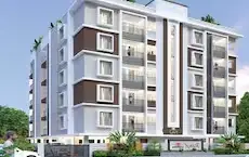
V-Infras Vrindavan
Muslammolla Yadagiri & Others · Rangareddy · RERA P02400010853
V-INFRAS VRINDAVAN is a residential open plotted layout at Chatanpally, Farooqnagar mandal, Ranga Reddy district, developed by the registered promoter Muslammolla Yadagiri & Others. The layout has a net area of 21,776.8 sq. m and 77 residential plots, with plot sizes of 141.1–314.04 sq. m (168.8–375.6 sq. yd). It is registered under TG-RERA number P02400010853, and the promoter’s declared completion date is 22-Jan-2029.
01What we found
Read from TG-RERA filings, approvals, land and registration records and court records. A court case is counted only when the court record states this project's survey number with its village, or names the project.
02Check before you pay
7 items to check before you pay, 4 high - from the title chain, court records and approvals, each with what to ask the builder or your advocate. An item may not be a problem with the project: records can be incomplete.
1. Project at a glance
Project identity
| Field | Record |
|---|---|
| Registered project name | V-INFRAS VRINDAVAN RERA record |
| Project type | Plotted development / residential open plotted layout RERA record |
| Phase / registered portion | New project; the registration and layout records identify a plotted layout on Sy. No. 711/Part. No separate phase name is disclosed. RERA record RERA filing |
| TG-RERA registration | P02400010853 RERA record |
| Registration validity | 22/01/2026 to 22/01/2029; validity is distinct from the completion undertaking below. RERA record |
| Registered promoter | Muslammolla Yadagiri & Others RERA record |
| RERA status | Registered; the certificate states a three-year registration period, subject to its conditions. RERA record |
Land and geographic identity
| Field | Record |
|---|---|
| Locality / revenue village | Chatanpally; the filed land and layout records also render the village as Chattanpally or CHATTANPALLY. RERA record |
| Mandal | Farooqnagar RERA record |
| District | Ranga Reddy (also rendered as Rangareddy in layout documents) RERA record |
| PIN | 509216 RERA record |
| Project survey identity | Sy. No. 711/Part; approval documents render this as 711/PART. RERA record Land records |
| Registered site extent | 21,776.8 sq. m net layout area RERA filing |
| Other layout area figure | The layout drawing states Total Layout Area (sq.m) 21,874.7 and Net Layout Area (sq.m) 21,776.8, with Road Widening Area (sq.m) 97.9. Layout record |
| Boundaries | East: Neighbours Land; West: Neighbours Land; North: Neighbours Land; South: “Naighbours Land” as filed. RERA filing |
Development identity
| Field | Record |
|---|---|
| Sanctioning authority | Hyderabad Metropolitan Development Authority (HMDA); the draft layout letter records delegation to Shadnagar Municipality. Approvals record |
| Principal layout permit | 1520/HMDA/SWDL/2026, dated 22/01/2026; described in the filed approval as a draft layout / technical approval. Approvals record |
| Layout area allocation | Plotted area 12,802.11 sq. m (58.79%); roads 6,610.54 sq. m (30.36%); open space 1,640.53 sq. m (7.53%); social infrastructure 545.83 sq. m (2.51%); utilities 177.77 sq. m (0.82%). Layout record |
| Plot count | 77 plots, as read from the layout drawing’s plot schedule. Layout record |
| Built-up area / buildings and floors | Not applicable as a residential plot offering in the supplied layout record; no building count or floor configuration is disclosed. RERA filing |
| Parking | The layout drawing records Common Parking Area 0.00 sq. m; individual plot parking provisions or allocations are not established in the supplied records. |
Offering and status
| Field | Record |
|---|---|
| Unit type | Residential plots RERA record |
| Plot sizes | Software-read from the layout drawing: 141.1–314.04 sq. m (168.8–375.6 sq. yd); median 150.5 sq. m (180.0 sq. yd). The drawing-derived plot count and sizes should be checked against the source drawing. Layout record |
| Booked / available plots | Not disclosed in the supplied project records. |
| Construction stage | Registration and layout approval records are available; no independently verified site-construction progress is supplied. The layout approval requires development works before final layout release. |
| Completion undertaking | Form B declares completion by 22-Jan-2029. This is the promoter’s declared project completion date, not the registration expiry date. |
| Completion / occupancy certificate | No completion certificate or occupancy certificate is supplied. The project is a plotted development; the supplied documents describe final layout release as pending completion of specified layout works. |
2. The project story
V-INFRAS VRINDAVAN is registered as a residential plotted development at Chatanpally, Farooqnagar mandal, Ranga Reddy district, on Sy. No. 711/Part. The RERA-filed layout drawing depicts 77 plots within a net layout area of 21,776.8 sq. m. The plan allocates land to plots, internal roads, open space, social infrastructure and utilities. RERA record Layout record
The HMDA records describe a draft layout / technical approval, with final layout release dependent on completion of the specified development works and handover arrangements. They also state that building construction in the plots is not permitted until final layout issuance. The supplied record does not establish that those works are complete or that a final layout has been released. The RERA registration is valid through 22/01/2029; separately, the promoter’s Form B completion undertaking states 22-Jan-2029. No site-verified progress or completion/occupancy certificate is provided.
3. Master plan, architecture & building design
The approved-layout drawing records a plotted scheme rather than apartment or building blocks. It shows 77 plots and a land-use allocation across a net layout area of 21,776.8 sq. m. The drawing states total layout area of 21,874.7 sq. m, net layout area of 21,776.8 sq. m, and road-widening area of 97.9 sq. m. Layout record
| Layout use | Area | Share stated on drawing |
|---|---|---|
| Plotted area | 12,802.11 sq. m | 58.79% |
| Roads | 6,610.54 sq. m | 30.36% |
| Open space | 1,640.53 sq. m | 7.53% |
| Social infrastructure | 545.83 sq. m | 2.51% |
| Utilities | 177.77 sq. m | 0.82% |
| Common parking | 0.00 sq. m | 0% |
| Amenities | 0.00 sq. m | 0% |
| Buffer area | 0.00 sq. m | 0% |
| Green belt area | 0.00 sq. m | 0% |
The drawing-derived plot-size schedule records 77 plots with sizes from 141.1 sq. m (168.8 sq. yd) to 314.04 sq. m (375.6 sq. yd); the median is 150.5 sq. m (180.0 sq. yd). These are software-read measurements from the drawing, not RERA-filed saleable areas, and should be verified against the drawing. Layout record
The documents refer to internal roads, cycle tracks, footpaths, parks/open space, a utility area and social-infrastructure area. They do not establish apartment-style building footprints, floor configurations, or a clubhouse or other building amenity block. The stated road widths include 9.14m, 30.0m, 30'0" and 100'0" in the layout record.
4. Homes, configurations & floor plans
This is a plotted project, not an apartment configuration schedule. The RERA-filed layout drawing identifies 77 plots; booked and available counts are not supplied. The floor-plan review reports one layout sheet and no flats. Floor plans
| Plot information | Record |
|---|---|
| Plots shown | 77; drawing schedule basis Layout record |
| Smallest to largest measured plot | 141.1–314.04 sq. m (168.8–375.6 sq. yd) Layout record |
| Median measured plot | 150.5 sq. m (180.0 sq. yd) Layout record |
| Booked / available | Not disclosed |
| Carpet area / loading | Not applicable to the plot schedule; no plot-specific loading figure is supplied. |
The plot sizes are software-read from the layout drawing and should be checked against it. The supplied vendor record contains a “Plot” configuration entry of saleable 1673 Sq. Ft., but this is vendor-provided rather than a RERA-filed plot-size schedule; no vendor figure is used here to describe the RERA offering. Layout record Promoter website
5. Parking & vehicle circulation
The approved layout drawing records Common Parking Area 0.00 sq. m. The supplied records do not establish a sanctioned common parking-space count, visitor or accessible parking, individual plot parking allocation, or a legally documented parking entitlement for a purchaser.
The layout documents describe internal roads and footpaths, road formation, storm-water drainage and cycling tracks as development works. They do not provide a vehicle-space count or plot-wise parking arrangement.
6. Amenities, recreation & open spaces
The following facilities are shown or described in the layout and approval records. The records identify proposed layout infrastructure and approval conditions; they do not provide independently verified completion status. RERA amenities
| Facility | Description / size | Evidence source | Declared progress / verified status |
|---|---|---|---|
| Open space / park | 1,640.53 sq. m (7.53%) | Layout allocation | Shown in the layout; development is required by approval conditions. Completion not independently verified. |
| Social infrastructure area | 545.83 sq. m (2.51%) | Layout allocation | Allocated in the layout; no specific facility or completed use identified. |
| Utility area | 177.77 sq. m (0.82%) | Layout allocation | Allocated in the layout; no completed status supplied. |
| Internal roads and footpaths | Road area 6,610.54 sq. m (30.36%); approval records describe paved footpaths and road works. | Layout and approval records | Required development works; completion not independently verified. |
| Cycling tracks | To be developed within the layout; no size stated. | Approval conditions | Required by the approval record; completion not independently verified. |
| Avenue plantation / greenery | Plantation along roads and green foliage are described; no quantity stated. | Approval conditions | Required development; completion not independently verified. |
The layout drawing allocates 0.00 sq. m to amenities and 0.00 sq. m to common parking. The vendor separately lists kids’ play areas/sand pits and a “Large Green Area”; these are vendor claims and are not described here as sanctioned or delivered facilities. Promoter website
7. Utilities, building services & safety
The HMDA layout conditions describe proposed or required infrastructure including underground drainage, a common septic tank / STP, internal water-supply pipelines, overhead tank and sumps, an assured/protected water-supply source, electrical supply lines, transformers, street lighting, underground utility ducting, storm-water drainage, rainwater-harvesting pits, solid-waste disposal space and a bio-compost unit. No capacity figures or independently verified completion evidence are supplied.
The approval record also requires road and footpath works, street lighting, avenue plantation, a transformer yard, source segregation of garbage, and cycling tracks. For layouts under 10 acres, the approval describes a septage-treatment mechanism; the supplied record does not establish that the utility works have been installed or commissioned.
No project-specific fire-system installation, security system, CCTV, lift, backup-power, accessibility design or service-capacity details are established in the supplied layout documents. The vendor lists treated water supply, 24 x 7 security, CCTV/video surveillance and rainwater harvesting, but these are vendor claims rather than verified completion evidence. Promoter website
8. Location, access & connectivity
The registered location is Chatanpally, Farooqnagar mandal, Ranga Reddy district, Telangana, PIN 509216, on Sy. No. 711/Part. RERA record
The layout approval describes internal roads, access to neighbouring sites, footpaths and road widths including 9.14m, 30.0m, 30'0" and 100'0". The location record identifies the nearest sampled Outer Ring Road interchange at 29.3 km. This is a recorded distance, not a travel-time estimate. Location record
The vendor provides additional connectivity claims for NH 44, schools, a hospital, a store and Shadnagar Railway Station; those claims are not used as verified distances or access details in this overview. Promoter website
9. Developer & development status
The registered promoter is Muslammolla Yadagiri & Others. The project record identifies the organization type as Others, described as Joint Individuals; a company registration number, registered office and official contact details are not disclosed in the supplied material. RERA record RERA filing Parties record
Form B is an affidavit-cum-declaration by Mr Muslammolla Yadagiri, described as authorized by the promoter, dated 18-April-2026. It declares title to the land, states that the land is free from encumbrances, and undertakes project completion by 22-Jan-2029. These are promoter declarations, not independent verification.
The HMDA layout documents identify M/s SIA Elite Builders and Developers Pvt Ltd and named individuals in the layout application/ownership descriptions. The supplied record does not establish that company as the TG-RERA registered promoter. The file also identifies GS Sreedevi, LTP licence CA/2009/46164, as the licensed technical person.
The project is registered, but the supplied evidence does not establish completed layout infrastructure or final layout release. The promoter’s stated completion date is distinct from the RERA registration validity end date; both are 22 January 2029.
10. Approvals, official records & documents
| Identifier / date | P02400010853; valid 22/01/2026–22/01/2029 |
|---|---|
| What the supplied record establishes | Form C registration certificate for V-INFRAS VRINDAVAN; not a conveyance or agreement for sale. |
| Identifier / date | 1520/HMDA/SWDL/2026, 22/01/2026 |
|---|---|
| What the supplied record establishes | Technical/draft layout approval for the plotted layout; conditions provide for development works and final layout release. |
| Identifier / date | Sy. No. 711/PART; drawing records 77 plots |
|---|---|
| What the supplied record establishes | Draft residential open plotted layout plan with area allocation and approval conditions. |
| Identifier / date | 008707/HMDA/02565/SWDL/SKP1/2025 |
|---|---|
| What the supplied record establishes | Application/file reference appearing in the layout processing and draft-approval records. |
| Identifier / date | 184/2026, dated 06/01/2026 |
|---|---|
| What the supplied record establishes | The approval record identifies plots 67 to 77, extent 1,991.34 sq. m, mortgaged in favour of the Metropolitan Commissioner, HMDA. |
| Identifier / date | 182/2026, dated 06/01/2026 |
|---|---|
| What the supplied record establishes | The approval record refers to the 97.9 sq. m road-affected area. |
| Identifier / date | Dated 18-April-2026 |
|---|---|
| What the supplied record establishes | Promoter declaration including the completion undertaking of 22-Jan-2029. |
The supplied project documents do not include a final layout release, project-specific completion certificate or occupancy certificate. The HMDA portal’s approved-layout lookup is reported as not publicly reachable in the evidence pack; that unavailability does not establish approval refusal. HMDA
1. Project at a glance
Project identity
Registered project name: V-INFRAS VRINDAVAN
Project type: Plotted development / residential open plotted layout
Phase / registered portion: New project; the registration and layout records identify a plotted layout on Sy. No. 711/Part. No separate phase name is disclosed.
TG-RERA registration: P02400010853
Registration validity: 22/01/2026 to 22/01/2029; validity is distinct from the completion undertaking below.
Registered promoter: Muslammolla Yadagiri & Others
RERA status: Registered; the certificate states a three-year registration period, subject to its conditions.
Land and geographic identity
Locality / revenue village: Chatanpally; the filed land and layout records also render the village as Chattanpally or CHATTANPALLY.
Mandal: Farooqnagar
District: Ranga Reddy (also rendered as Rangareddy in layout documents)
PIN: 509216
Project survey identity: Sy. No. 711/Part; approval documents render this as 711/PART.
Registered site extent: 21,776.8 sq. m net layout area
Other layout area figure: The layout drawing states Total Layout Area (sq.m) 21,874.7 and Net Layout Area (sq.m) 21,776.8, with Road Widening Area (sq.m) 97.9.
Boundaries: East: Neighbours Land; West: Neighbours Land; North: Neighbours Land; South: “Naighbours Land” as filed.
Development identity
Sanctioning authority: Hyderabad Metropolitan Development Authority (HMDA); the draft layout letter records delegation to Shadnagar Municipality.
Principal layout permit: 1520/HMDA/SWDL/2026, dated 22/01/2026; described in the filed approval as a draft layout / technical approval.
Layout area allocation: Plotted area 12,802.11 sq. m (58.79%); roads 6,610.54 sq. m (30.36%); open space 1,640.53 sq. m (7.53%); social infrastructure 545.83 sq. m (2.51%); utilities 177.77 sq. m (0.82%).
Plot count: 77 plots, as read from the layout drawing’s plot schedule.
Built-up area / buildings and floors: Not applicable as a residential plot offering in the supplied layout record; no building count or floor configuration is disclosed.
Parking: The layout drawing records Common Parking Area 0.00 sq. m; individual plot parking provisions or allocations are not established in the supplied records.
Offering and status
Unit type: Residential plots
Plot sizes: Software-read from the layout drawing: 141.1–314.04 sq. m (168.8–375.6 sq. yd); median 150.5 sq. m (180.0 sq. yd). The drawing-derived plot count and sizes should be checked against the source drawing.
Booked / available plots: Not disclosed in the supplied project records.
Construction stage: Registration and layout approval records are available; no independently verified site-construction progress is supplied. The layout approval requires development works before final layout release.
Completion undertaking: Form B declares completion by 22-Jan-2029. This is the promoter’s declared project completion date, not the registration expiry date.
Completion / occupancy certificate: No completion certificate or occupancy certificate is supplied. The project is a plotted development; the supplied documents describe final layout release as pending completion of specified layout works.
2. The project story
V-INFRAS VRINDAVAN is registered as a residential plotted development at Chatanpally, Farooqnagar mandal, Ranga Reddy district, on Sy. No. 711/Part. The RERA-filed layout drawing depicts 77 plots within a net layout area of 21,776.8 sq. m. The plan allocates land to plots, internal roads, open space, social infrastructure and utilities.
The HMDA records describe a draft layout / technical approval, with final layout release dependent on completion of the specified development works and handover arrangements. They also state that building construction in the plots is not permitted until final layout issuance. The supplied record does not establish that those works are complete or that a final layout has been released. The RERA registration is valid through 22/01/2029; separately, the promoter’s Form B completion undertaking states 22-Jan-2029. No site-verified progress or completion/occupancy certificate is provided.
3. Master plan, architecture & building design
The approved-layout drawing records a plotted scheme rather than apartment or building blocks. It shows 77 plots and a land-use allocation across a net layout area of 21,776.8 sq. m. The drawing states total layout area of 21,874.7 sq. m, net layout area of 21,776.8 sq. m, and road-widening area of 97.9 sq. m.
| Layout use | Area | Share stated on drawing |
|---|---|---|
| Plotted area | 12,802.11 sq. m | 58.79% |
| Roads | 6,610.54 sq. m | 30.36% |
| Open space | 1,640.53 sq. m | 7.53% |
| Social infrastructure | 545.83 sq. m | 2.51% |
| Utilities | 177.77 sq. m | 0.82% |
| Common parking | 0.00 sq. m | 0% |
| Amenities | 0.00 sq. m | 0% |
| Buffer area | 0.00 sq. m | 0% |
| Green belt area | 0.00 sq. m | 0% |
The drawing-derived plot-size schedule records 77 plots with sizes from 141.1 sq. m (168.8 sq. yd) to 314.04 sq. m (375.6 sq. yd); the median is 150.5 sq. m (180.0 sq. yd). These are software-read measurements from the drawing, not RERA-filed saleable areas, and should be verified against the drawing.
The documents refer to internal roads, cycle tracks, footpaths, parks/open space, a utility area and social-infrastructure area. They do not establish apartment-style building footprints, floor configurations, or a clubhouse or other building amenity block. The stated road widths include 9.14m, 30.0m, 30'0" and 100'0" in the layout record.
4. Homes, configurations & floor plans
This is a plotted project, not an apartment configuration schedule. The RERA-filed layout drawing identifies 77 plots; booked and available counts are not supplied. The floor-plan review reports one layout sheet and no flats.
Plots shown: 77; drawing schedule basis
Smallest to largest measured plot: 141.1–314.04 sq. m (168.8–375.6 sq. yd)
Median measured plot: 150.5 sq. m (180.0 sq. yd)
Booked / available: Not disclosed
Carpet area / loading: Not applicable to the plot schedule; no plot-specific loading figure is supplied.
The plot sizes are software-read from the layout drawing and should be checked against it. The supplied vendor record contains a “Plot” configuration entry of saleable 1673 Sq. Ft., but this is vendor-provided rather than a RERA-filed plot-size schedule; no vendor figure is used here to describe the RERA offering.
5. Parking & vehicle circulation
The approved layout drawing records Common Parking Area 0.00 sq. m. The supplied records do not establish a sanctioned common parking-space count, visitor or accessible parking, individual plot parking allocation, or a legally documented parking entitlement for a purchaser.
The layout documents describe internal roads and footpaths, road formation, storm-water drainage and cycling tracks as development works. They do not provide a vehicle-space count or plot-wise parking arrangement.
6. Amenities, recreation & open spaces
The following facilities are shown or described in the layout and approval records. The records identify proposed layout infrastructure and approval conditions; they do not provide independently verified completion status.
| Facility | Description / size | Evidence source | Declared progress / verified status |
|---|---|---|---|
| Open space / park | 1,640.53 sq. m (7.53%) | Layout allocation | Shown in the layout; development is required by approval conditions. Completion not independently verified. |
| Social infrastructure area | 545.83 sq. m (2.51%) | Layout allocation | Allocated in the layout; no specific facility or completed use identified. |
| Utility area | 177.77 sq. m (0.82%) | Layout allocation | Allocated in the layout; no completed status supplied. |
| Internal roads and footpaths | Road area 6,610.54 sq. m (30.36%); approval records describe paved footpaths and road works. | Layout and approval records | Required development works; completion not independently verified. |
| Cycling tracks | To be developed within the layout; no size stated. | Approval conditions | Required by the approval record; completion not independently verified. |
| Avenue plantation / greenery | Plantation along roads and green foliage are described; no quantity stated. | Approval conditions | Required development; completion not independently verified. |
The layout drawing allocates 0.00 sq. m to amenities and 0.00 sq. m to common parking. The vendor separately lists kids’ play areas/sand pits and a “Large Green Area”; these are vendor claims and are not described here as sanctioned or delivered facilities.
7. Utilities, building services & safety
The HMDA layout conditions describe proposed or required infrastructure including underground drainage, a common septic tank / STP, internal water-supply pipelines, overhead tank and sumps, an assured/protected water-supply source, electrical supply lines, transformers, street lighting, underground utility ducting, storm-water drainage, rainwater-harvesting pits, solid-waste disposal space and a bio-compost unit. No capacity figures or independently verified completion evidence are supplied.
The approval record also requires road and footpath works, street lighting, avenue plantation, a transformer yard, source segregation of garbage, and cycling tracks. For layouts under 10 acres, the approval describes a septage-treatment mechanism; the supplied record does not establish that the utility works have been installed or commissioned.
No project-specific fire-system installation, security system, CCTV, lift, backup-power, accessibility design or service-capacity details are established in the supplied layout documents. The vendor lists treated water supply, 24 x 7 security, CCTV/video surveillance and rainwater harvesting, but these are vendor claims rather than verified completion evidence.
8. Location, access & connectivity
The registered location is Chatanpally, Farooqnagar mandal, Ranga Reddy district, Telangana, PIN 509216, on Sy. No. 711/Part.
The layout approval describes internal roads, access to neighbouring sites, footpaths and road widths including 9.14m, 30.0m, 30'0" and 100'0". The location record identifies the nearest sampled Outer Ring Road interchange at 29.3 km. This is a recorded distance, not a travel-time estimate.
The vendor provides additional connectivity claims for NH 44, schools, a hospital, a store and Shadnagar Railway Station; those claims are not used as verified distances or access details in this overview.
9. Developer & development status
The registered promoter is Muslammolla Yadagiri & Others. The project record identifies the organization type as Others, described as Joint Individuals; a company registration number, registered office and official contact details are not disclosed in the supplied material.
Form B is an affidavit-cum-declaration by Mr Muslammolla Yadagiri, described as authorized by the promoter, dated 18-April-2026. It declares title to the land, states that the land is free from encumbrances, and undertakes project completion by 22-Jan-2029. These are promoter declarations, not independent verification.
The HMDA layout documents identify M/s SIA Elite Builders and Developers Pvt Ltd and named individuals in the layout application/ownership descriptions. The supplied record does not establish that company as the TG-RERA registered promoter. The file also identifies GS Sreedevi, LTP licence CA/2009/46164, as the licensed technical person.
The project is registered, but the supplied evidence does not establish completed layout infrastructure or final layout release. The promoter’s stated completion date is distinct from the RERA registration validity end date; both are 22 January 2029.
10. Approvals, official records & documents
| Identifier / date | P02400010853; valid 22/01/2026–22/01/2029 |
|---|---|
| What the supplied record establishes | Form C registration certificate for V-INFRAS VRINDAVAN; not a conveyance or agreement for sale. |
| Identifier / date | 1520/HMDA/SWDL/2026, 22/01/2026 |
|---|---|
| What the supplied record establishes | Technical/draft layout approval for the plotted layout; conditions provide for development works and final layout release. |
| Identifier / date | Sy. No. 711/PART; drawing records 77 plots |
|---|---|
| What the supplied record establishes | Draft residential open plotted layout plan with area allocation and approval conditions. |
| Identifier / date | 008707/HMDA/02565/SWDL/SKP1/2025 |
|---|---|
| What the supplied record establishes | Application/file reference appearing in the layout processing and draft-approval records. |
| Identifier / date | 184/2026, dated 06/01/2026 |
|---|---|
| What the supplied record establishes | The approval record identifies plots 67 to 77, extent 1,991.34 sq. m, mortgaged in favour of the Metropolitan Commissioner, HMDA. |
| Identifier / date | 182/2026, dated 06/01/2026 |
|---|---|
| What the supplied record establishes | The approval record refers to the 97.9 sq. m road-affected area. |
| Identifier / date | Dated 18-April-2026 |
|---|---|
| What the supplied record establishes | Promoter declaration including the completion undertaking of 22-Jan-2029. |
The supplied project documents do not include a final layout release, project-specific completion certificate or occupancy certificate. The HMDA portal’s approved-layout lookup is reported as not publicly reachable in the evidence pack; that unavailability does not establish approval refusal.
Frequently asked questions
Is V-INFRAS VRINDAVAN registered with Telangana RERA?
Yes. V-INFRAS VRINDAVAN is registered with the Telangana Real Estate Regulatory Authority as P02400010853; the registration status is New Project.
Who is the developer of V-INFRAS VRINDAVAN?
The promoter named in the RERA registration is Muslammolla Yadagiri & Others.
Where is V-INFRAS VRINDAVAN located?
V-INFRAS VRINDAVAN is in Chatanpally, Farooqnagar, Rangareddy, Telangana (509216).
When will V-INFRAS VRINDAVAN be completed?
The promoter's proposed date of completion filed with RERA is 22/05/2029. This is the promoter's declaration, not a guarantee.
More projects in Chatanpally